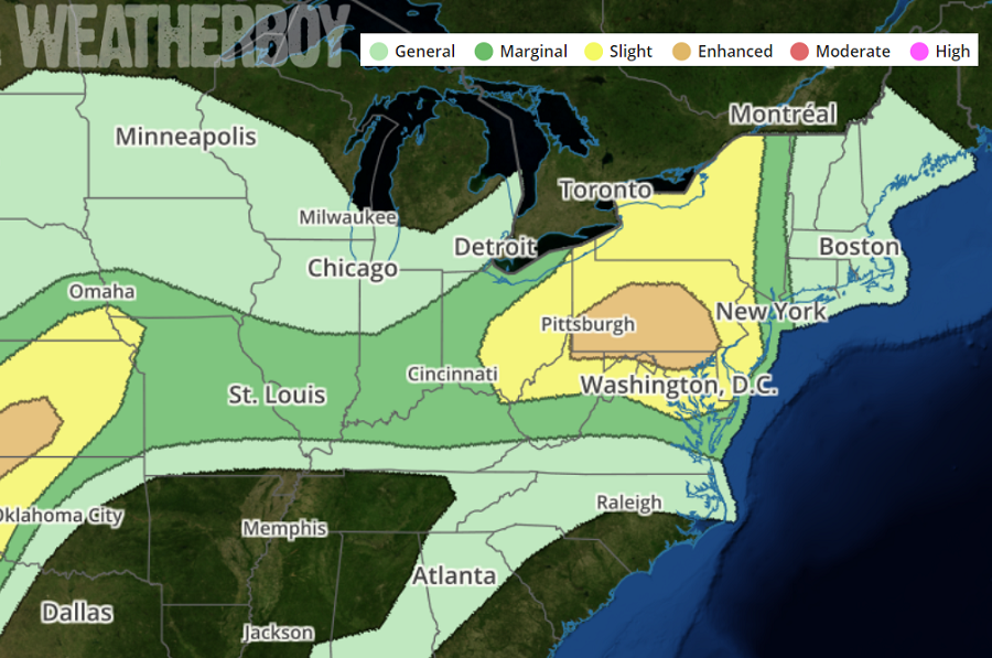
While severe weather in the Midwest continues today and will carry over into tomorrow, a new area of trouble is expected to form over portions of the northeast tomorrow. Severe storms with large hail, damaging wind and tornadoes will be possible over a part of the central and southern Plains Thursday. Other severe storms with a threat for mainly damaging wind and large hail are expected from a portion of the Ohio Valley into the northern Middle Atlantic.
A short-wave trough in the central United States is forecast to eject northeast across the Great Lakes and flatten the eastern ridge as passes across Lake Erie. This feature is expected to aid early-morning convection across the Ohio Valley which will propagate into eastern Ohio and western Pennsylvania by lunchtime. Depending on the evolution of this convection it appears environmental shear will become favorable for sustaining fast-moving organized updrafts. The latest computer forecast model guidance suggests upward-evolving thunderstorms by the early afternoon hours within a strengthening westerly flow regime. Boundary-layer heating is expected to be maximized from south-central Pennsylvania, south along the lee of the central Appalachians. If a cold pool develops early, severe thunderstorms should initiate along the eastern-southern-southwestern flank of this activity then spread/develop east-southeast toward the DelMarVa Peninsula. Damaging winds, and some hail, are expected with convection as it spreads across eastern Ohio and Pennsylvania towards northern Maryland by late afternoon. Thunderstorms should reach New York City and the Jersey shore by evening.
While damaging winds and hail are the primary threat in the severe weather region in the northeast, an isolated tornado or two cannot be ruled out. People within areas highlighted by the National Weather Service’s Storm Prediction Center should be prepared to take immediate action should Severe Thunderstorm or Tornado Warnings be issued during the day.
