Atmospheric conditions are ripe for yet another severe weather threat in the northeast on Thursday, one of many severe weather events to unfold there this year. In addition to thunderstorms containing damaging wind gusts and large hail, there is also an elevated risk of tornadoes from northern New Jersey north and east through to northern New England. Scattered severe thunderstorms capable of producing mainly damaging wind gusts appear likely over parts of the Northeast due to a variety of atmospheric ingredients coming together to spark another severe weather outbreak.
According to the National Weather Service’s Storm Prediction Center (SPC), A weakening mid/upper-level trough and related cold front will move through parts of the Northeast and New England on Thursday. In advance of the front, diurnal heating of a relatively moist air mass will result in moderate destabilization. Generally, the more unstable the atmosphere is, the more likely severe weather can form. Initial development may occur as early as late morning, with an increase in storm coverage and intensity expected as convection spreads eastward through the afternoon. Upper level winds will support the potential for organized multicell clusters and a few supercells. Damaging wind gusts are expected to be the most prominent threat, as low-level lapse rates steepen across the region prior to storm arrival. Low-level flow and shear will also support the potential for isolated tornadoes with any sustained supercell in the northeast. The SPC also cautions that even though midlevel lapse rates are relatively weak, isolated hail will also be possible, especially with any discrete cells.
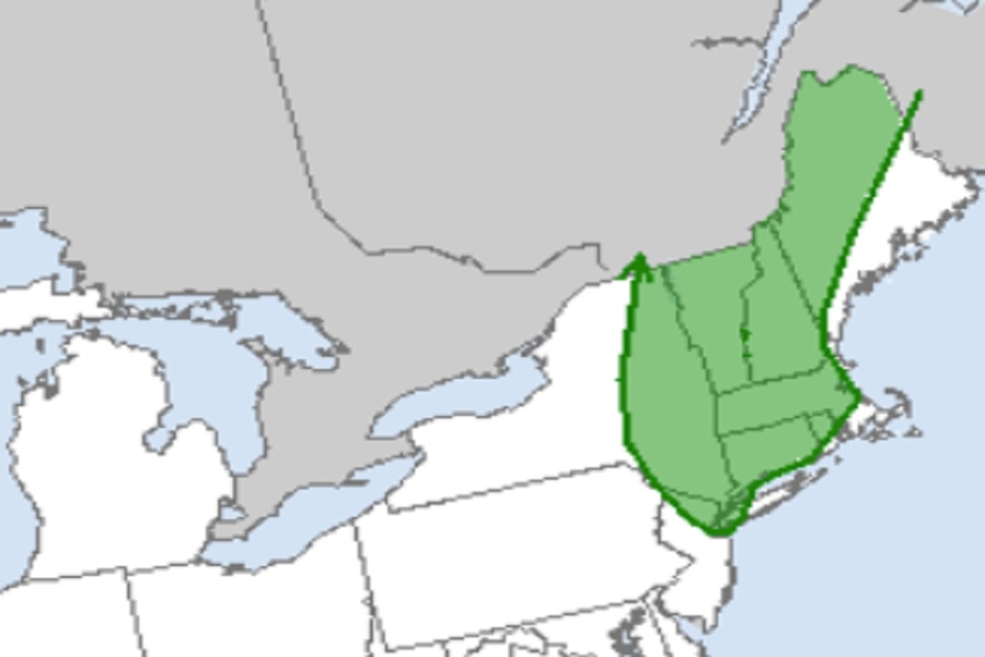
While thunderstorms are likely to blossom throughout the northeast, the greatest risk of tornadoes will be within that severe weather zone. Specifically, northern New Jersey, southeastern New York including the New York City metro area, eastern Upstate New York, all of Vermont and Connecticut, most of Rhode Island, Massachusetts, and New Hampshire, and portions of western and northern Maine are at an elevated risk of seeing tornadic thunderstorms. Not everyone in this area will see a severe thunderstorm and even less people will see a tornado, but the threat of tornadoes in the U.S. will be greatest in the northeast on Thursday.
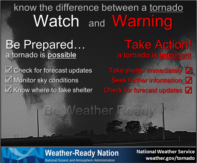
With a severe weather outbreak unfolding, it is likely the National Weather Service will issue Severe Thunderstorm or Tornado Watches and Warnings. Before they’re even issued, people throughout the northeast should become acquainted with the watch and warning language and know what they’d do if such a watch/warning is issued in their area.
Thursday’s frontal passage and severe weather threat will have an upside though: it will help cut the oppressive humidity down in the region. While dangerously hot and humid conditions are expected through Thursday, broad mid-level troughing arriving from the west early Thursday will linger through much of Friday. At the surface, modest southwesterly return flow will then prevail through Thursday advecting even warmer temperatures and dewpoints into the dewpoint. The cold front bringing the severe weather will push into the northeast late Thursday and move off-shore Thursday night. The front will stall just south of the Mid Atlantic and linger there much of Friday. While Friday will see temperatures generally similar to that of Thursday across the Northeast and Mid Atlantic, dewpoints will be 10 degrees or lower resulting in Heat Indices that will be 10-20 degrees colder than they are today and Thursday. However, while conditions won’t be as oppressive as Thursday, it will still be quite hot. The lower dewpoints and drier mid-level air will result in an otherwise fair weather day under sunny skies across much of the northeast on Friday.
