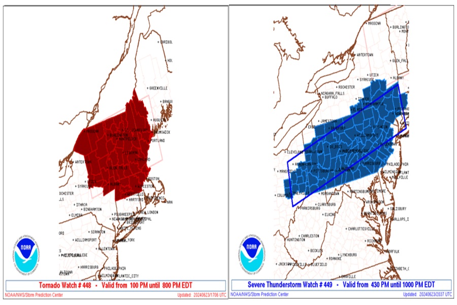
There are severe thunderstorm and tornado threats persisting in portions of the Northeast and Mid Atlantic this evening. A Tornado Watch remains in effect until 9pm across portions of southern Maine and New Hampshire while a Severe Thunderstorm Watch remains in effect over much of New Jersey and Pennsylvania until 10 pm. Thunderstorms with damaging wind gusts and isolated tornadoes are possible in both watch areas.
According to the National Weather Service’s Storm Prediction Center, ongoing convection over New England has decreased in coverage and intensity over the last couple of hours. While some buoyancy remains over southern New England, the loss of diurnal heating amid poor mid lapse rates, will favor a continued downtrend in convective intensity this evening. Still, a few damaging gusts will remain possible, with isolated ongoing storms given relatively robust shear profiles.
Farther south over the Mid Atlantic, several bands of storms have developed ahead of the slow-moving cold front over western/central
Pennsylvania and West Virginia. Deep-layer shear remains favorable for organized multi-cells and or brief supercell structures. However, the gradual onset of nocturnal stabilization and the loss of forcing from the departing mid-level wave to the north suggests the threat of additional severe storm formation will be somewhat diminished. The potential for damaging gusts will persist for a few more hours as storms encounter diminishing residual buoyancy.
The Storm Prediction Center cautions that while the severe threat should generally decrease over the broader Mid Atlantic and upper Ohio Valley this evening, somewhat greater storm coverage and perhaps a locally greater risk may persist over parts of southern/central Pennyslvania into northwestern Maryland through the overnight hours. Here, the greatest risk will be from damaging wind gusts in severe storms.
