A very significant storm surge is possible in portions of Florida later this week as Hurricane Ian, an intensifying tropical cyclone, approaches the U.S. in the coming days. Because of the threat of storm surge and other hurricane-related dangers, numerous watches and warnings have been issued by the National Hurricane Center.
A Hurricane Warning has been issued for the Dry Tortugas; one is also in effect for Englewood to the Anclote River, including Tampa Bay. A Hurricane Warning means that hurricane conditions are expected somewhere within the warning area, in this case within 24 to 36 hours. Preparations to protect life and property should be rushed to completion.
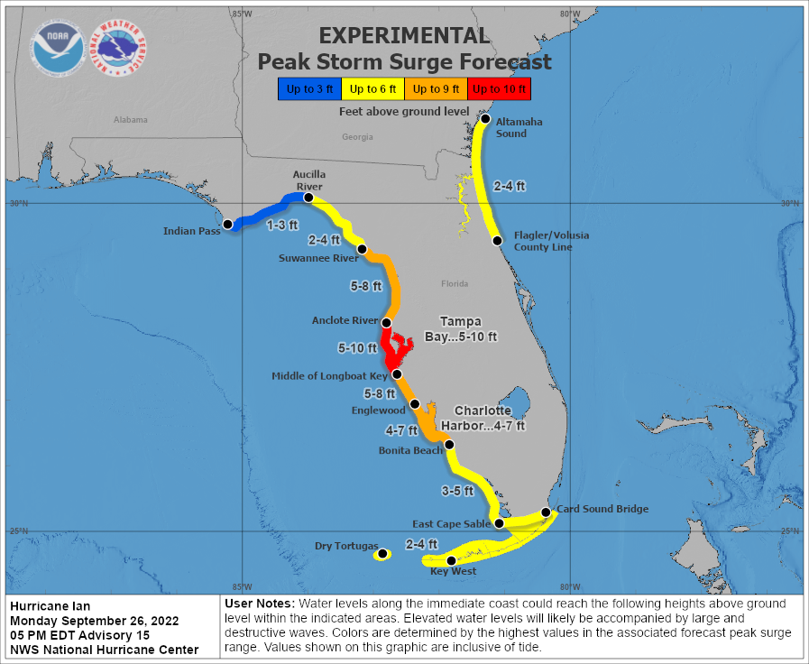
A Storm Surge Warning has been issued for Anclote River southward to Flamingo, including Tampa Bay. A Storm Surge Warning means there is a danger of life-threatening inundation, from rising water moving inland from the coastline, during the next 36 hours in the indicated locations. The National Hurricane Center warns, “This is a life-threatening situation. Persons located within these areas should take all necessary actions to protect life and property from rising water and the potential for other dangerous conditions. Promptly follow evacuation and other instructions from local officials.”

A Storm Surge Watch has been issued for Altamaha Sound to the Flagler/Volusia County Line, including the St. Johns River. A Storm Surge Watch is also in effect for Florida Keys from the Card Sound Bridge westward to Key West, the Dry Tortugas, Florida Bay, and the Aucilla River to the Anclote River. A Storm Surge Watch means there is a possibility of life-threatening inundation, from rising water moving inland from the coastline, in the indicated locations during the next 48 hours.
A Hurricane Watch has been issued from Bonita Beach to Englewood. The Hurricane Watch is also in effect north of the Anclote River to the Suwannee River. A Hurricane Watch means that hurricane conditions are possible within the watch area. A watch is typically issued 48 hours before the anticipated first occurrence of tropical-storm-force winds, conditions that make outside preparations difficult or dangerous.
The Tropical Storm Watch has been upgraded to a Tropical Storm Warning from Englewood southward to Flamingo.. A Tropical Storm Watch has been issued from the Suwannee River to Indian Pass, and from Jupiter Inlet to Altamaha Sound. A Tropical Storm Warning means that tropical storm conditions are expected somewhere within the warning area within 36 hours while a Tropical Storm Watch means those conditions are possible in the area in the next 36 hours too.
One of the greatest impacts from this storm could be storm surge flooding. The intense hurricane could slow as it approaches the Florida Gulf Coast, which would allow water to collect along the coast. With water unable to drain during normal tide cycles, the water could become especially high and head inland, submerging coastal communities. Right now, the greatest threat of highest storm surge is in and around the Tampa Bay area; however, a very significant storm surge is also possible south of there into Captiva and Sanibel Islands, Fort Meyers Beach, Naples, and Bonita Beach as well as north towards Crystal River and Cedar Key.


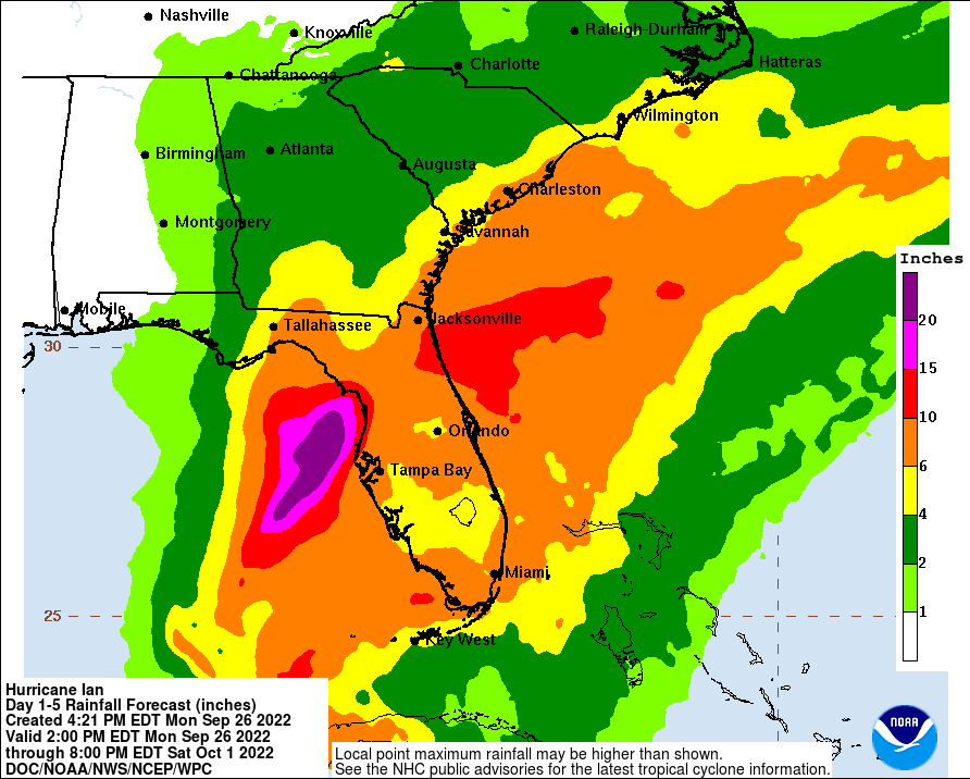
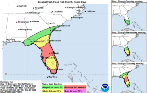
Another significant impact from this hurricane will be heavy, flooding rains. With the storm forecast to slow, heavy rain will have the ability to accumulate even more. There is a considerable threat of flooding across northern portions of Florida as the storm slides through. 10-15″+ of rain is possible north of Tampa Bay and south of Jacksonville; such totals could create extreme flooding situations.
In addition to heavy rain threats, there are also risks from damaging wind gusts and tornadoes. Winds could gust over 100 mph in hurricane warning areas, which could damage some buildings. People in weak structures not up to code, including mobile homes and RVs, should head to safer areas outside of Hurricane and Tropical Storm Warning zones.
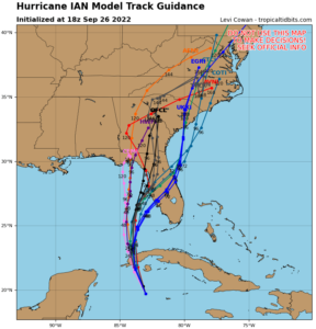
Right now, Hurricane Ian is located about 155 miles southeast of the western tip of Cuba. Maximum sustained winds have increased to 100 mph. It is moving to the north-northwest at 13 mph. The minimum central pressure is 972 mb ot 28.71″.
The National Hurricane Center is expressing concerns for 4 key areas with this storm: hurricane conditions through tomorrow, life-threatening impacts to Florida, future hurricane-force winds, and flood threats.
Life-threatening storm surge, hurricane-force winds, flash floods and possible mudslides are expected in portions of western Cuba beginning this evening and continuing into Tuesday. Devastating wind damage is possible where the core of Ian moves across western Cuba. The National Hurricane Center says efforts to protect life and property should be rushed to completion there.
The National Hurricane Center also says there is the danger of life-threatening storm surge along much of the Florida west coast where a storm surge warning has been issued, with the highest risk from Fort Myers to the Tampa Bay region. Residents in these areas should listen to advice given by local officials.
Hurricane-force winds are expected in the hurricane warning area in west-central Florida beginning Wednesday morning with tropical storm conditions expected by late Tuesday.
Heavy rainfall will increase across the Florida Keys and south Florida Tuesday, spreading to central and northern Florida Wednesday and Thursday, potentially causing flash, urban and small stream flooding. Significant prolonged river flooding is likely across central Florida.