Hawaii Governor David Ige signed an Emergency Declaration for all of the islands of Hawaii as a significant blizzard and the Kona Low it came from winds down. “I’ve just signed an emergency declaration for the entire State of Hawaii as heavy rains from a Kona Low weather system are anticipated to continue to cause flooding and damage to public and private property,”Governor Ige announced on Twitter. “The emergency declaration allows the state to use funds[sic] to support state and county efforts in providing quick and efficient relief of suffering, damage, and losses caused by flooding and other effects of heavy rains,” the Governor added. The emergency relief period continues through Friday, December 10.

Starting on Friday, a significant storm system known locally as a “Kona Low” moved through the state, bringing heavy rains, blizzard conditions and heavy snow, 100-125+ mph winds, and extreme surf from the Big Island of Hawaii in the east to Kauai in the west. The Kona Low gets its name from the change in wind direction that occurs when such a storm moves over the Hawaii Islands. Hawaii is dominated by the trade winds that typically blow in from the northeast. However, the counter-clockwise flow around a Kona low located west of Hawaii results in southwesterly winds over the islands, which is typically the leeward or “Kona” side. Kona Lows are most common between October and April. These type of storms draw abundant moisture up from the warm tropical waters that surround Hawaii; when this moist flow interacts with the steep topography of the islands which helps to wring-out moisture, extremely heavy precipitation can fall. Because the wind flow around a Kona Low is atypical, flooding rains occur in places that may not ordinarily flood in tropical downpours that impact the islands from time to time.
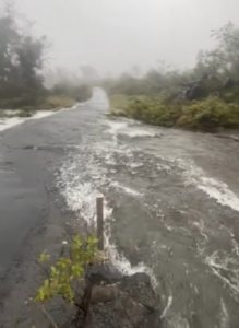
Before the worst of the storm hit on Sunday, local emergency management and National Weather Service officials were using extreme language to get storm warnings out “The National Weather Service forecasts this to be a Catastrophic Flooding Event with 20 to 25 inches of rainfall in isolated areas of Hawaii Island; know that rain events of this magnitude can affect areas that do not usually flood,” warned Hawaii County Civil Defense in a statement that was shared frequently across island radio stations on the weekend. Residents in flood prone areas were asked to remain alert for flooding conditions, and to be prepared for sudden road closures, possible landslides, downed trees, and utility disruptions.

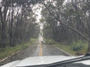
Unfortunately, all of those warned threats came to fruition. On Maui, Emergency Management reported several homes flooded in the Maui Meadows subdivision. “Vehicles have been washed away while others were stranded between flooded culverts,” Maui Emergency Management reported. In Honolulu on the island of Oahu, a National Weather Service meteorologist reported that he saw basement apartments there were flooded with at least 3″ of water on Isenberg Street in Moiliili; he assed parked cars had water up to the bottom of their doors there. In Kaaawa on Oahu, the rain was responsible for a rockfall which included a 3′ boulder landing onto the Kamehameha Highway. On the Big Island, Hawaii County Civil Defense reported that widespread strong wind gusts caused numerous power outages from Volcano to Lower Puna with the greatest impacts observed in Lower Puna.
On the Big Island of Hawaii, Hawaii Volcanoes National Park is urging visitors to come back another day. While the park is technically open, many areas are closed due to storm damage. In a statement released by the park, they caution, “Internet, phone, and power outages continue and services are limited as teams assess damage and begin cleanup this week.” Sections of Crater Rim Drive (east), Chain of Craters Road, Hilina Pali Road, Mauna Loa Road, and Kīpukapuaulu are closed due to down trees, heavy rains, high winds, and dangerous road conditions.

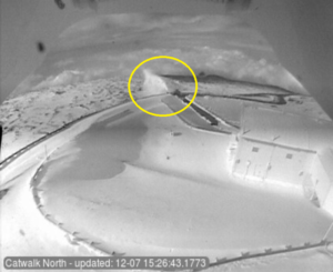
Roads that enter into areas hit hard by blizzard conditions remain closed, waiting for snow plow crews to dig them out. Rangers responsible for opening and closing the road to Mauna Kea, the Big Island’s tallest summit, released a statement reminding the public that the Mauna Kea Access Road remains closed. In an afternoon update today, rangers announced, “Crews are in the process of removing the ice and snow from the roads but more ice is expected overnight. Rangers will continue monitoring the road and weather conditions as well as the progress of the road crews and will reopen the road as soon as the conditions are safe.”
The significant winter storm helped to topple many weather records. Honolulu Airport recorded 7.92″ on December 6, breaking the previous daily record of 4.11″ in 1988 and the single day record in the month of December, which was 7.89″ in 1987. Honolulu also saw unusually “cold” temperatures on December 4, with the high temperature of 70°F becoming a new monthly record of lowest high; it was also the coldest high temperature since January 1979. Morning lows on the 4th dipped down to 59 at Lihue on Kauai, 65 at Kahului on Maui, 58 at Kaunakakai on Molokai, and 67 at Hilo and 68 at Kona on the Big Island of Hawaii. Hilo also saw a record low high temperature; the 71 degree reading was colder than its previous low high of 74. While temperatures in the 50’s and 60’s are not considered very cold for those on the U.S. mainland during December, they are exceptionally cold in Hawaii where most homes lack insulation and home heating.
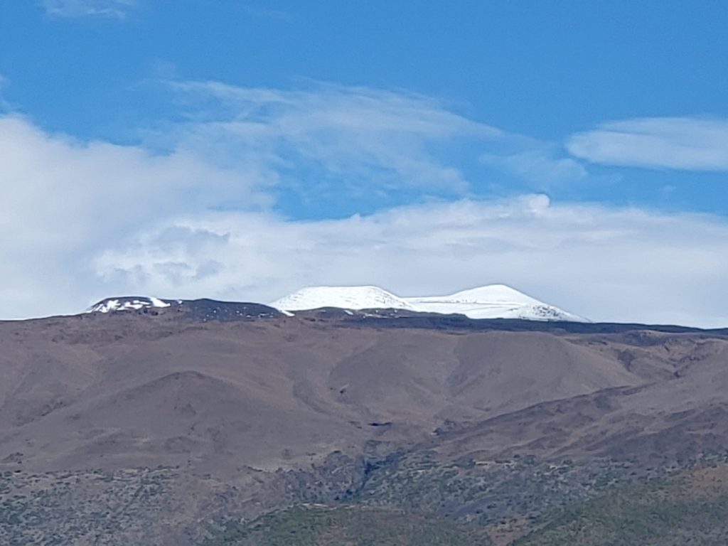
The sun is finally out above Hawaii Island’s peaks, revealing snow capped Mauna Kea & Mauna Loa from the weekend blizzard. Some heavy rains persist over western portions of both the Big Island & Oahu now, but the worst of the #KonaLow winter storm is over. #HIwx @NWSHonolulu pic.twitter.com/Bq0cqoOdFC
— the Weatherboy (@theWeatherboy) December 7, 2021