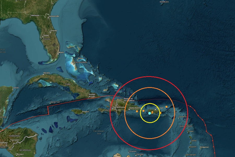
A stronger than usual earthquake struck Puerto Rico today in an area that has seen seismic unrest for many years. Due to the strength of the earthquake, the National Weather Service Tsunami Warning Center in Honolulu, Hawaii, which is responsible for also tracking tsunami threats in the Caribbean, issued an information statement shortly after clarifying that no tsunami threat exists at this time.
According to USGS, a magnitude 4.8 earthquake struck just outside of Guanica, Puerto Rico on the island’s southwest coast from a depth of 7.0 km. Today’s earthquake was the 147th to hit the area over the last 3 weeks, illustrating just how seismically active it is.
According to USGS, earthquakes with a magnitude of 2.0 or less are rarely felt or heard by people, but once they exceed 2.0 , more and more people can feel them. While damage is possible with magnitude 3.0 events or greater, significant damage and casualties usually don’t occur until the magnitude of a seismic event rises to a 5.5 or greater rated event.
The Tsunami Warning Center released a brief bulletin shortly after the earthquake. They wrote, “Based on all available data, there is no tsunami threat to Puerto Rico, the U.S. Virgin Islands, or the British Virgin Islands from this earthquake.” They added, “This will be the only statement issued for this event unless additional data are received or the situation changes.”
Today’s earthquake in Puerto Rico isn’t far from the epicenter of a strong earthquake that hit in January 2020. That 6.4 created extensive damage in Puerto Rico, including widespread power failures across much of the island. An earthquake swarm started here in December 2019 and unrest has continued since.
Nearby Haiti is also no stranger to severe earthquakes. A catastrophic 7.0 earthquake struck 16 miles west of Haiti’s capital of Port-au-Prince in 2010. According to the Haitian government, roughly 220,000-316,000 people were killed while 250,000 homes and 30,000 businesses collapsed or were severely damaged. All in all, roughly 3 million people were directly impacted by that earthquake.
These earthquakes are occurring near the northern edge of the Caribbean Plate, a mostly oceanic tectonic plate underlying Central America and the Caribbean Sea off of the north coast of South America. The Caribbean Plate borders the North American Plate, the South American Plate, the Nazca Plate, and the Cocos Plate. The borders of these plates are home to ongoing seismic activity, including frequent earthquakes, occasional tsunamis, and sometimes even volcanic eruptions.
USGS continues to monitor earthquake activity in and around Puerto Rico while the National Weather Service Tsunami Warning Center is keeping an eye on any tsunami threats.
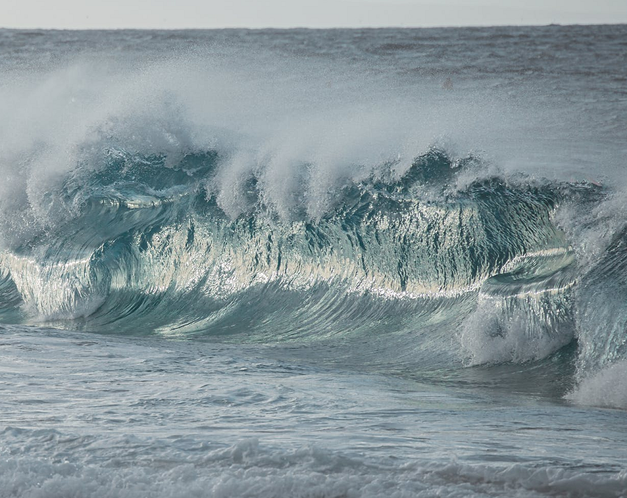
Tsunamis are giant waves caused by earthquakes or volcanic eruptions under the sea. Out in the depths of the ocean, tsunami waves do not dramatically increase in height. But as the waves travel towards the coast, especially within shallow coastal waters, they build up to higher and higher heights as the depth of the ocean decreases. The speed of tsunami waves depends on ocean depth rather than the distance from the source of the wave. Tsunami waves may travel as fast as jet planes over deep waters, only slowing down when reaching shallow waters. While tsunamis are often referred to as tidal waves, this name is discouraged by oceanographers because tides have little to do with these giant waves.
An earthquake causes a tsunami when it abruptly shifts the seafloor vertically during a major underwater or coastal earthquake. This sudden motion pushes a massive column of water upward or drops it downward. Gravity then forces the displaced water to regain its balance, sending powerful waves racing outward in all directions.
While the Pacific is better known for tsunamis, tsunami can and does occur in the Atlantic basin too. As with the Pacific basin, earthquakes can trigger a tsunami threat for the U.S. East and Gulf coasts. According to USGS, submarine landslides can be one result of an Atlantic-based quake. An offshore earthquake with a magnitude 4.5 or greater can destabilize the continental shelf, causing massive underwater avalanches. These landslides displace large volumes of water and can generate significant, localized tsunamis. This was the case during the 1929 Grand Banks earthquake near Canada, which caused a destructive localized tsunami. Distant tectonic earthquakes can also create problems; massive earthquakes along faults further away in the Atlantic, such as the Azores-Gibraltar Transform Fault near Portugal or the Puerto Rico Trench in the Caribbean, are capable of generating tsunami waves that travel across the ocean. While the infamous 1755 Lisbon earthquake created a trans-Atlantic tsunami that was recorded on the East Coast, the height of the waves reaching the US mainland was relatively small but different earthquake intensities and locations can trigger very different results.
