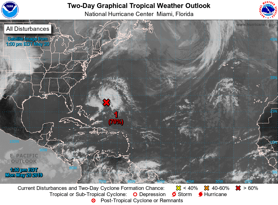
The National Hurricane Center (NHC) now believes there’s a 70% chance that a subtropical or tropical cyclone will form south and west of Bermuda well east of the Florida coast within the next 24 hours. Should the system get named, it would be called Andrea.
According to the NHC, showers and thunderstorms associated with a broad area of low pressure located several hundred miles southwest of Bermuda are showing signs of organization. Although recent satellite wind data suggest that the system currently lacks a well-defined center of circulation, environmental conditions are expected to be conducive for the formation of a short-lived subtropical or tropical cyclone later today or tonight. Conditions are forecast to become unfavorable for further development by late Tuesday, and the disturbance is expected to merge with a cold front on Wednesday.
The NHC reports that an Air Force Reserve “Hurricane Hunter” reconnaissance aircraft is currently en route to investigate the disturbance.
Interests in Bermuda, including cruise and cargo ships traveling between the U.S. East Coast, Bermuda, and the Bahamas should closely monitor this developing storm system.
The 2019 Atlantic Hurricane Season officially kicks off on June 1 but storms often do form end of May ahead of the full season.