• Skip to primary navigation
  • Skip to main content
  • Skip to primary sidebar

Weatherboy

Weatherboy Weather News, Maps, RADAR, Satellite, and Forecasts.

  • Local
  • Earth Science News
  • RADAR
  • Current Warnings
  • Satellite
  • Current Maps
  • Forecast Maps
  • Video

Sunday Severe Weather Threat Zones Refined for Tornado and Flood Threats

by Weatherboy Team Meteorologist - June 12, 2022

Areas that could see tornadic thunderstorms today are shaded in green. Image: NWS/SPC


The National Weather Service’s Storm Prediction Center (SPC) and Weather Prediction Center (WPC) have both drastically refined their previously identified areas of tornado risk and flash flood risk for today.  Due to a variety of atmospheric ingredients that evolved differently than initially projected, both the SPC and WPC have scaled back areas where very bad weather was initially expected to occur today and tonight.

Thunderstorms are possible in any shaded region, with green, then yellow, then orange being greater risk zones of severe storms. Image: NWS/SPC

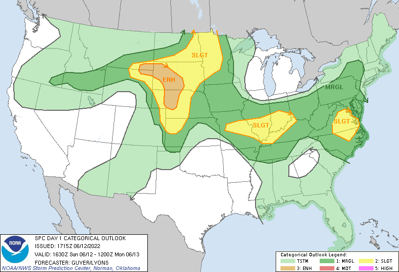
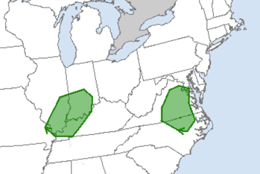
While thunderstorms are still likely across the Northeast, Mid Atlantic, and Ohio River Valley, the greatest risk of tornadic cells will remain over portions of Virginia and North Carolina and a portion of western Kentucky and southern Indiana and Illinois. According to the SPC, a cluster of strong to severe storms will continue to impact far southeast Virginia vicinity through early afternoon. Otherwise, a relatively moist and potentially unstable air mass is present to the west of these early day storms. The SPC adds that forecast soundings suggest sufficient deep-layer shear for convective organization and perhaps a supercell or two today. Overall, with most thunderstorms in the eastern U.S. today, locally damaging winds are the main threat through the early evening.


The area shaded in green could see exceptionally heavy rain and areas of flash flooding later Sunday into Sunday night. Image: NWS/WPC
The WPC initially felt that the  area shaded in green could see exceptionally heavy rain and areas of flash flooding late Sunday into Sunday night. However, this is no longer the case. Image: NWS/WPC

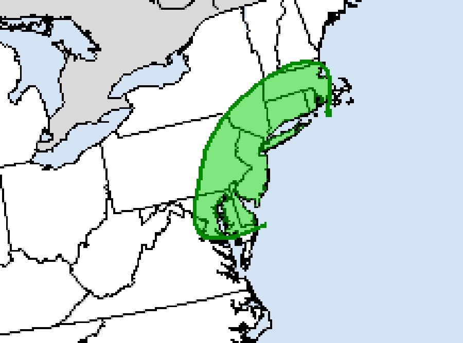
The precipitation potential has also dropped from previous forecasts. At this time, the WPC does not believe showers will be heavy enough to reach flash flood criteria in the northeast. Yesterday, they believed there could be a flash flood threat around portions of New Jersey, Delaware, Connecticut, Rhode Island, Massachusetts, and  eastern Pennsylvania and Maryland, but that is no longer the case. While heavy rain could fall from scattered storms today and tonight, the risk of flash flooding from those showers should remain low.

Primary Sidebar

Sponsored Ad

Search

Latest News

  • Dozens Report Shaking from Ohio Earthquake
  • Second Earthquake in Two Days Rattles Eastern Tennessee
  • Tennessee Latest State in the East to Experience an Earthquake Today
  • “Kona Low” Brings Heavy Snow to Hawaii Prompting Winter Storm Warnings
  • Weak Early Morning Earthquake Rattles North Carolina
  • Early Morning Earthquake Rattles New Hampshire; Hundred+ Report Shaking
  • Cape Canaveral Prepares for Tsunami with TsunamiReady Certification
  • Weak Earthquake Shakes Georgia, South and East of Atlanta
About | Careers | Contact | Contests
Terms | Privacy | Ad Choices
Weatherboy is a (R) Registered Trademark of isarithm LLC, All Rights Reserved.
All content herein is Copyright by Isarithm LLC 1997-2022

Insert/edit link

Enter the destination URL

Or link to existing content

    No search term specified. Showing recent items. Search or use up and down arrow keys to select an item.