The weather system being tracked and monitored by the National Hurricane Center (NHC) for signs of tropical cyclone development will likely bring soaking showers and storms to portions of the southeast in the coming days, especially to northeastern Florida, southern Georgia, and much of South and North Carolina. The NHC doesn’t expect the system to develop into a tropical or subtropical storm but even so, soaking rains are likely to spread over this region in the coming days.
The disturbance being tracked by the NHC is unlikely to develop much, but it will bring soaking showers and storms to parts of Florida, Georgia, and the Carolinas this week, as reflected in the latest NAM model run: pic.twitter.com/zKPG3TL29V
— the Weatherboy (@theWeatherboy) June 3, 2025
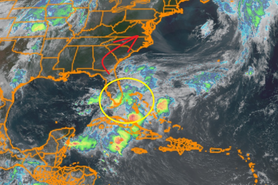
According to this afternoon’s Tropical Outlook issued by the NHC, environmental conditions appear only marginally conducive for the low they’re tracking to gradually develop some subtropical or tropical characteristcs later this week as it moves north into the southeastern U.S. The system is forming along a frontal boundary that is draped across south Florida. The NHC says that the low is forecast to move east of North Carolina over the Atlantic by late Friday or Saturday, bringing soaking showers and storms to the southeast between now and then.
The National Hurricane Center says it is unlikely this system will strengthen into a tropical storm. According to the Tropical Outlook, the chance of formation is only 10% over the next 48 hours or for the balance of the week.
