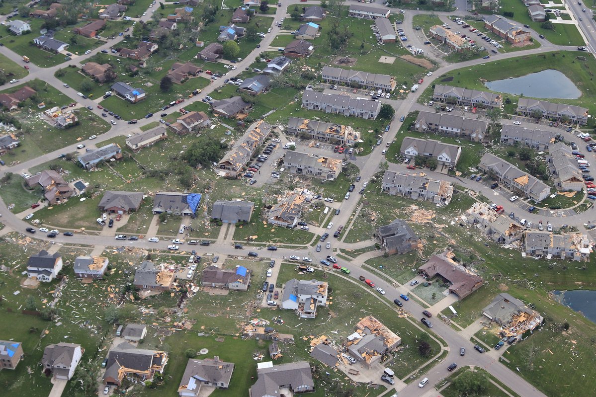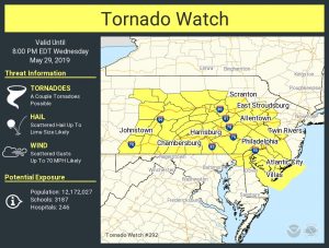
The National Weather Service’s Storm Prediction Center has issued a fresh Tornado Watch for portions of New Jersey, Pennsylvania, Delaware, and Maryland, a day after two confirmed tornadoes touched-down. The Mount Holly, NJ office of the National Weather Service has confirmed that a tornado touched down in both Berks County in Pennsylvania and Sussex County in New Jersey. With a Tornado Watch now up for the same area, more severe thunderstorms and the threat of an isolated tornado return this afternoon and evening.

A Tornado Watch is now up through 8pm for portions of extreme northern Delaware, extreme northeastern Maryland, western and southern New Jersey, much of central and eastern Pennsylvania, and nearby coastal waters. This area includes the entire Philadelphia metro area. The primary threats from thunderstorms in this area include a couple of possible tornadoes, scattered large hail likely with isolated very large hail events to 2″in diameter possible, and scattered damaging wind gusts to 70 mph likely. The tornado watch area is approximately along an area 60 statute miles north and south of a line from 40 miles northwest of Altoona, Pennsylvania to 10 miles east northeast of Trenton, NJ.
According to the Storm Prediction Center, scattered supercell development is expected this afternoon across central/eastern Pennsylvania . These storms are then forecast to move east-southeastward into New Jersey this afternoon and evening. Large hail and damaging winds are likely with these storms, and a couple of tornadoes will also be possible with storm and boundary interactions.
A Tornado Watch means conditions are favorable for tornadoes and severe thunderstorms in and close to the watch area. According to the National Weather Service, persons in these areas should be on the lookout for threatening weather conditions and listen for later statements and possible warnings.
While a fresh batch of severe weather is likely, experts from the National Weather Service’s Mount Holly, NJ office remain in the field in Berks County, Pennsylvania, and Sussex County, New Jersey, where they confirmed this morning that tornadoes touched down yesterday. In Sussex County, the office has determined that storm damage in Stanhope yesterday was indeed caused by a tornado. Among the places hit by this tornado was Lenape Valley High School. There, extensive damage to school grounds occurred while the school itself also saw damage; some of the roof caved in while an after-school banquet was being held. According to authorities there, two people were injured, but refused medical treatment. The survey team is still at the scene; they’ve yet to determine specifics such as path length, width, and maximum wind speed for this area. A more thorough report of what happened and where here should be released by tonight. The team in Berks County is currently working with county emergency management personnel. For the Pennsylvania tornado, an assessment of the damage has not yet been relayed back to the office at this time. As with the New Jersey tornado, a more thorough report is expected in later tonight.