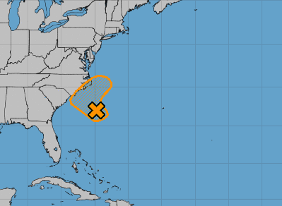
Odds are increasing that a tropical cyclone or subtropical cyclone could form along the U.S. East Coast this week; while those odds are improving, the National Hurricane Center is deploying an Air Force Reserve reconnaissance aircraft to investigate the disturbance.
Satellite images and surface observations indicate that a low pressure system located a couple of hundred miles east of the coast of South Carolina is gradually becoming better defined. Although the associated shower and thunderstorm activity is currently disorganized, the National Hurricane Center (NHC) says that environmental conditions could briefly become marginally conducive for the low to acquire subtropical characteristics by Saturday night and early Sunday.
By early next week, the low is expected to interact with a frontal boundary, which should end the opportunity for any subtropical or tropical formation. According to the latest NHC forecast, the low is forecast to meander offshore the Carolinas today, and then slowly move back toward the west-northwest and northwest on Saturday, bringing the system closer to the coast of North Carolina.
Even if the system doesn’t become a tropical or subtropical cyclone, intermittent periods of locally heavy rains and gusty winds will affect eastern portions of the Carolinas through the weekend.
The National Hurricane Center has been boosting odds for development of this system over tine; two days ago, there was a 10% chance of formation; yesterday, those odds grew to 20%. Today, odds are at a moderate 30% chance. Those odds will likely be updated one reconnaissance aircraft data is analyzed by NHC forecasters.