• Skip to primary navigation
  • Skip to main content
  • Skip to primary sidebar

Weatherboy

Weatherboy Weather News, Maps, RADAR, Satellite, and Forecasts.

  • Local
  • Earth Science News
  • RADAR
  • Current Warnings
  • Satellite
  • Current Maps
  • Forecast Maps
  • Video

Tropics Come to Life; New Tropical Storm Possible in Atlantic

by Weatherboy Team Meteorologist - June 27, 2024

Latest satellite view shows two circled areas of concern being monitored in the tropics; the red area has the greatest chance of becoming a tropical storm. Image: NOAA


The tropics are coming to life, with a new tropical storm possible in the Atlantic Hurricane Basin over the coming days. The National Hurricane Center (NHC) is tracking 2 disturbances that could become a tropical cyclone over time, although one over the far Atlantic is the more likely of the two to become something of concern.

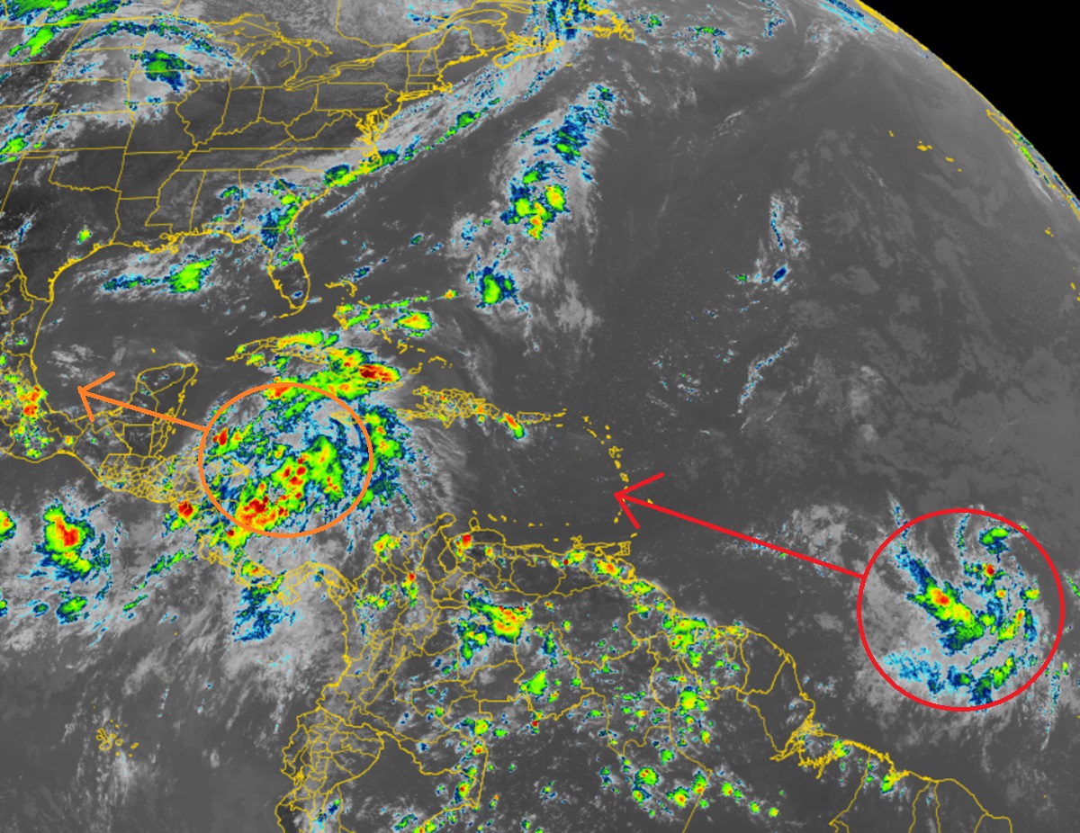
A tropical wave located several hundred miles west-southwest of the Cabo Verde Islands continues to produce disorganized shower and thunderstorm activity. According to the NHC, environmental conditions are forecast to be conducive, and development of this system is anticipated. A tropical depression or tropical storm is likely to form this weekend several hundred miles east of the Windward Islands while the system moves westward at 15 to 20 mph. “Interests in the Lesser Antilles should monitor the progress of this system,” warns the NHC.  At this time, the NHC believes there’s an 80% chance that a storm will form here over the next 7 days; there’s a 60% chance that it may even form within the next 2 days.

The next tropical storm to form in the Atlantic will be named Beryl.

Latest Tropical Outlook issued by the National Hurricane Center. Image: NHC


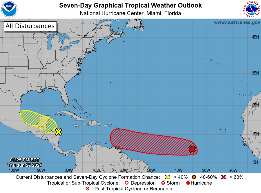
The second area being watched is over the western Caribbean and the Southwestern Gulf of Mexico. According to the NHC, a broad area of low pressure over the western Caribbean Sea is producing widespread but disorganized shower and thunderstorm activity while it moves west-northwestward at around 15 mph. Some development of this system is possible over the northwestern Caribbean Sea or over the southwestern Gulf of Mexico during the next few days. The NHC says there’s only a 30% chance that this area will develop over the next 7 days.


Primary Sidebar

Sponsored Ad

Search

Latest News

  • Soviet Union Spacecraft Crash Zones Updated; NJ/NY/PA/MI at Increased Risk
  • Over 2,000 People Report Shaking from Virginia Earthquake
  • Morning Earthquake Strikes Heart of New Madrid Seismic Zone in Missouri Today
  • New York TV Weatherman Back After Brain Injury
  • NASA Monitoring Significant Magnetic Anomaly over Atlantic
  • Out of Control Soviet Union Spacecraft Could Crash Into Your House This Week
  • Elevated Tornado Threat in New Jersey, Pennsylvania, and New York
  • Significant Severe Weather Outbreak Likely Today
About | Careers | Contact | Contests
Terms | Privacy | Ad Choices
Weatherboy is a (R) Registered Trademark of isarithm LLC, All Rights Reserved.
All content herein is Copyright by Isarithm LLC 1997-2022