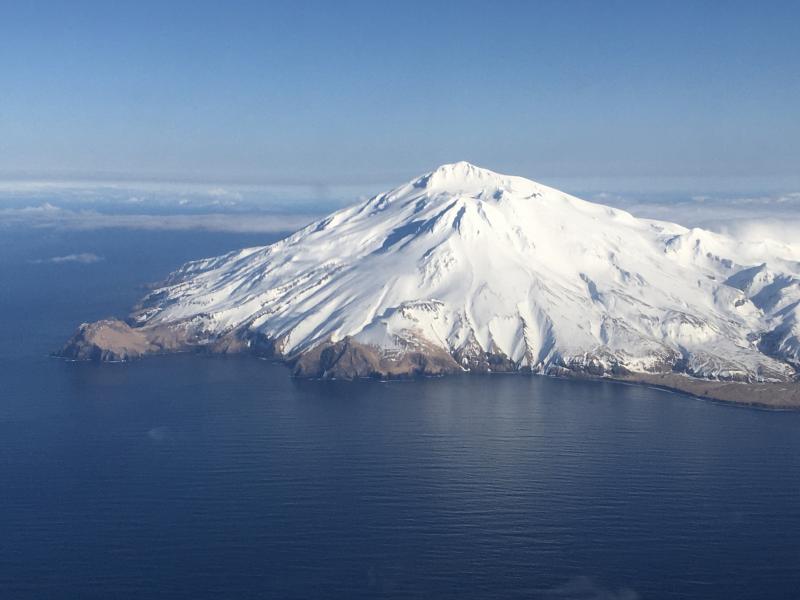
USGS is monitoring volcanoes around the United States and its territories; it has one at an alert level of WATCH and a color code of ORANGE while it has four others at an alert level of ADVISORY and a color code of YELLOW. The 4 volcanoes around the U.S. with the heightened alert level are Great Sitkin in Alaska (WATCH/ORANGE), Shishaldin in Alaska (ADVISORY/YELLOW), Kilauea in Hawaii (ADVISORY/YELLOW), and Kanaga in Alaska (ADVISORY/YELLOW). The fifth volcano is located in the Pacific Ocean well north of Guam; it is the Ahyi Seamount, submerged in the ocean about 200 feet below the surface . Overall, the USGS continues to monitor more than 160 volcanoes around the United States; beyond these 5 volcanoes, all of the other volcanoes USGS is monitoring today are either at GREEN or unrated conditions.
Within the United States, the USGS tracks dozens of potentially active volcanoes, most of which are in Alaska. In Alaska alone, there are more than 130 volcanoes and volcanic fields which have been active within the geologically young last 2 million years. 50 have been active since the mid 1700s and the Alaska Volcano Observatory (AVO) studies those too.
Another place famous for its volcanoes is Hawaii; on the Big Island of Hawaii, Kilauea, Mauna Loa, and Hualalai are considered active and potential threats. As of today, none are erupting but that could change in the coming days with signs of increased activity at Kilauea, the most active of the Hawaiian bunch.
The U.S. is only home to a fraction of the world’s volcanoes: according to USGS, there are normally around 2 dozen erupting volcanoes around the world at any given time. The USGS says there are about 1,500 potentially active volcanoes worldwide, with about 500 of the 1,500 erupting in modern historical times.
The Hawaii volcanoes are monitored by the Hawaii Volcano Observatory (HVO) while the Alaska volcanoes are monitored by the Alaska Volcano Observatory (AVO.) In addition to the AVO and HVO, there are also the California Volcano Observatory , Cascades Volcano Observatory, the Yellowstone Volcano Observatory, and the Northern Mariana Islands Volcano Observatory. Each of those additional volcano observatories within the USGS are monitoring volcanoes in their respective regions. At this time, none of those other observatories are reporting unusual activity or signs of anything more than background noise for now.
In the U.S., the USGS and volcano observatory units are responsible for issuing Aviation Codes and Volcanic Activity Alert Levels. Aviation Codes are green, yellow, orange, or red. When ground-based instrumentation is insufficient to establish that a volcano is at a typical background level of activity, it is simply “unassigned.” While green means typical activity associated with a non-eruptive state, yellow means a volcano is exhibiting signs of elevated unrest above known background levels. When a volcano exhibits heightened or escalating unrest with the increased potential of eruption, it jumps to orange. Finally, when an eruption is imminent with significant emission of volcanic ash expected in the atmosphere or an eruption is underway with significant emission of volcanic ash into the atmosphere, the code becomes red. Volcanic Activity Alert levels are normal, advisory, watch, or warning. As with aviation codes, if data is insufficient, it is simply labeled as “unassigned.” When the volcano is at typical background activity in a non-eruptive state, it is considered normal. If the volcano exhibits signs of elevated unrest above background level, an advisory is issued. If a volcano exhibits heightened or escalating unrest, a watch is issued while a warning is issued when a hazardous eruption is imminent.
The Great Sitkin Volcano is a basaltic andesite volcano that occupies most of the northern half of Great Sitkin Island, a member of the Andreanof Islands group in the central Aleutian Islands. It’s located roughly 26 miles east of Adak, which is 1,192 miles southwest of Anchorage. According to the AVO, the volcano has a composite structure consisting of an older dissected volcano and a younger parasitic cone with a 1.8 mile diameter summit crater. A steep-sided lava dome, emplaced during an eruption in 1974, occupies the center of the crater. Within the past 280 years, a large explosive eruption here produced pyroclastic flows that partially filled the Glacier Creek valley on the southwest flank.
According to AVO, a slow eruption of lava is continuing at the volcano, producing a thick lava flow within the summit crater. “An eruption of lava began at Great Sitkin Volcano in July 2021 and has continued to slowly erupt since, but no explosive events have occurred since a single event in May 2021,” wrote AVO in today’s daily update.
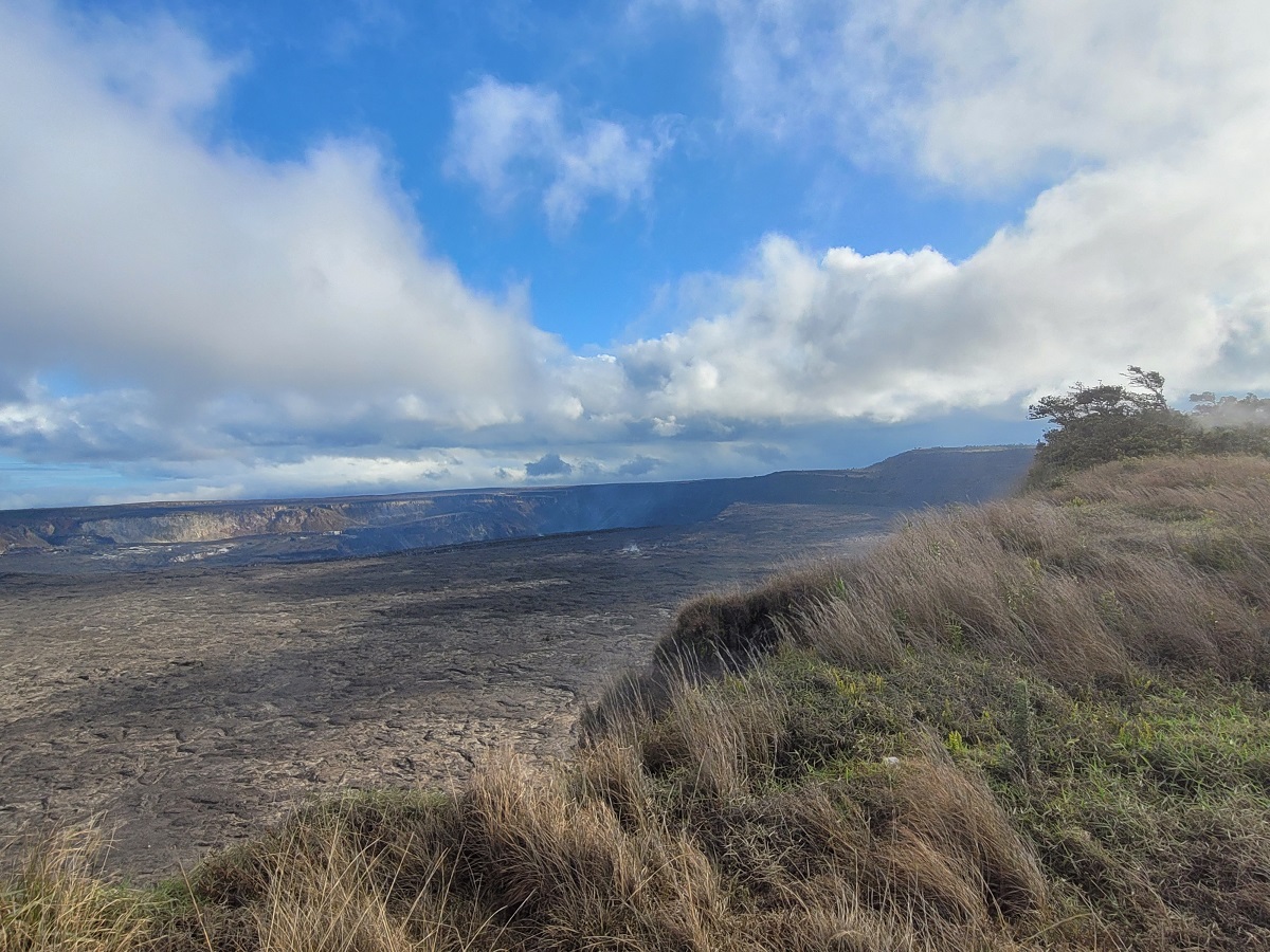
On the Big Island of Hawaii, the Kilauea volcano is not erupting, and no active lava has been observed since September, 2023. However, there has been a high, steady string of earthquakes around the volcano since Saturday; in the last 24 hours alone, there’s been 70 earthquakes at the volcano. HVO/USGS urges visitors of Hawaii Volcano National Park and Kilauea Volcano there to exercise extreme caution at all times. “Other significant hazards also remain around Kīlauea caldera from Halemaʻumaʻu crater wall instability, ground cracking, and rockfalls that can be enhanced by earthquakes within the area closed to the public. This underscores the extremely hazardous nature of the rim surrounding Halemaʻumaʻu crater, an area that has been closed to the public since early 2008. ”
In today’s update from HVO, they described the activity at Kilauea which is currently at Yellow / Advisory status. “Kilauea summit remains pressurized; in recent months unrest has escalated quickly, and an eruption could occur in the future with little warning. ”
HVO added to today’s Kilauea update, “South caldera seismicity continued through yesterday, becoming somewhat more widespread, but not increasing in event frequency. In general, rates have been fairly steady since Saturday morning. Periods of increased seismicity can be expected to continue during repressurization of the summit magma reservoir, which has been ongoing since the end of the September 2023 eruption”
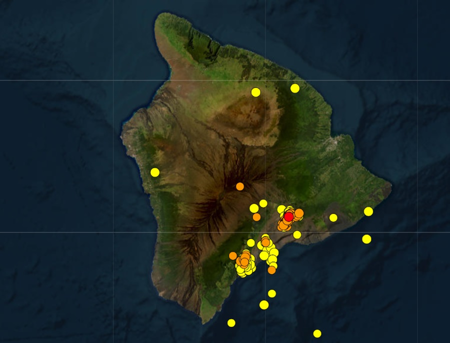
While Kilauea isn’t erupting now, the increased activity, which prompted the Yellow/Advisory status, could be indicative of something brewing at the volcano. Scientists at USGS and HVO will continue to monitor the activity; in addition to providing daily updates on its status, they will issue a special bulletin should signs of an eruption become apparent.
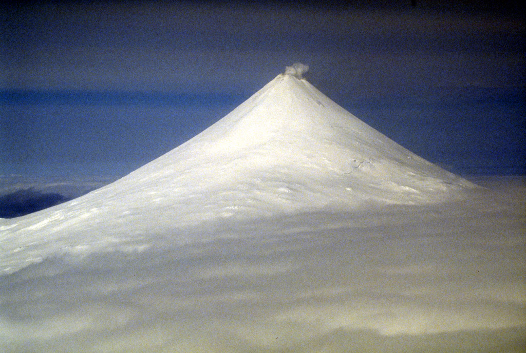
Another earthquake showing signs of unrest is Shisaldin in Alaska. Shishaldin Volcano is located on Unimak Island in the Aleutian Islands chain of Alaska; it is the highest mountain peak of the Aleutians, rising to 6,500 feet. It is a large stratovolcano; in 1967, it was designated as a National Natural Landmark by the National Park Service.
According to AVO, low-level unrest continues at Shishaldin Volcano in the form of small repeating volcanic earthquakes. AVO reports, “No explosive activity was detected in infrasound data. Minor steaming from the summit was observed in clear webcam views over the past day.”
According to USGS, there have been 14 significant explosive events that have occurred at Shishaldin since July 12, 2023 with the most recent occurring in November. These events have been preceded by increases in seismicity in the hours to days before they occur. It is unknown how long this period of ongoing activity will last. However, previous eruptions of Shishaldin Volcano have lasted weeks to months with repeated cycles of eruptive activity.
Shishaldin Volcano is monitored by local seismic and infrasound sensors, web cameras, and a telemetered geodetic network. In addition to the local monitoring network, AVO uses nearby geophysical networks, regional infrasound and lighting data, and satellite images to detect eruptions.
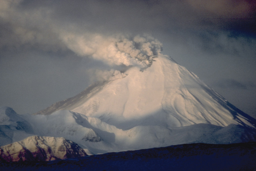
The Kanaga Volcano, also known as Mount Kanaga, is a stratovolcano at the northern tip of Kanaga Island in the Aleutian Islands, Alaska. It is situated within a caldera, which forms the arcuate Kanaton Ridge south and east of Kanaga. A crater lake occupies part of the southeast caldera floor.
According to AVO, Kanaga is also showing signs of unrest. In today’s update, AVO reports, “Infrequent, small volcanic earthquakes were detected over the past day” at the volcano. “A steam-driven explosion occurred at Kanaga on December 18, and seismic activity at the volcano has been above background. This unrest may mean that the likelihood for ash-producing explosive activity has increased.”
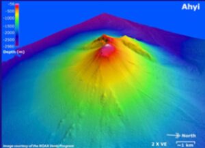
Ahyi seamount is a large conical submarine volcano that rises to within 300 feet of the ocean surface southeast of the island of Farallon de Pajaros in the northern Marianas. Water discoloration has been observed there, and in 1979 the crew of a fishing boat felt shocks over the summit area, followed by upwelling of sulfur-bearing water. In April 2001, an explosive eruption was detected seismically by a station on Rangiroa Atoll, Tuamotu Archipelago. The event was determined to be from the southern base of Ahyi. An eruption in April-May 2014 was again detected by NOAA divers, hydroacoustic sensors, and seismic stations.
While additional volcanic activity may happen here, USGS warns there is limited data around this volcano. In an update, the Northern Mariana Islands Volcano Observatory wrote, “There are no local monitoring stations near Ahyi Seamount, which limits our ability to detect and characterize volcanic unrest there.”
Nevertheless, unrest has prompted them to have the current volcano alert level there as ADVISORY while the aviation color code is YELLOW.