Despite internet rumors of a nor’easter brewing, the weekend forecast is looking more wet than white as another area of low pressure swings through. Unlike last weekend’s system that brought light snow to portions of the Mid Atlantic at the start of the storm, this next storm will be milder, resulting in much less snow and much more rain, even for central portions of New England.
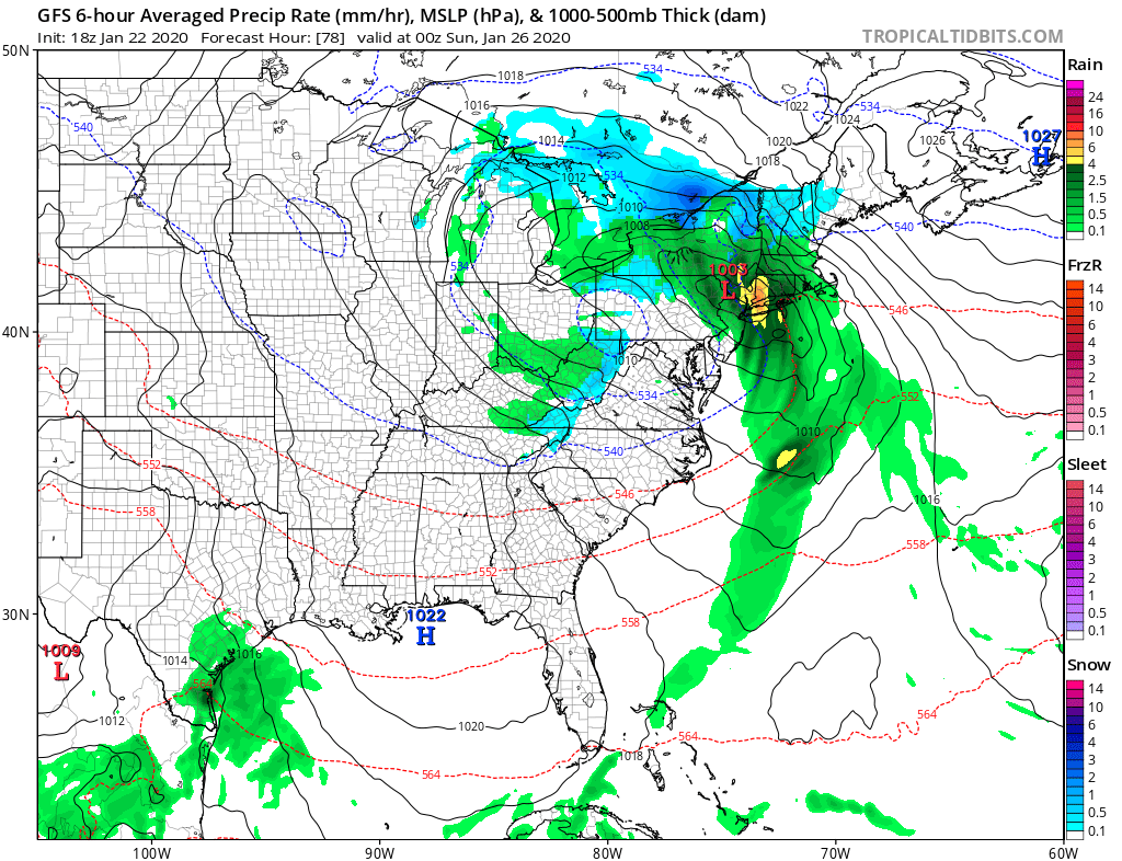
An area of low pressure moving in from the midwest will bring unsettled conditions to the East Coast at the end of the week. By Friday night, the primary low pressure system will advance north through the Midwestern states with a secondary low eventually forming over eastern Virginia by Saturday morning. Meanwhile, high pressure will continue retreating east through the Canadian Maritimes, taking most lingering cold air with it.
Unlike the last weekend storm, this storm doesn’t have much cold air to work with. Additionally, a more northerly track expected with this system means milder air will be able to surge into the northeast moreso than last time. As such, expect plain rain anywhere south of the I-78 corridor over southern Pennsylvania, southern New Jersey, and places south. A wintry mix is possible north of there, especially along the I-80 corridor, but that too feature more sleet and rain than snow. On Saturday, these two lows, known as a “double-barreled” system, will march into the northeast, with the primary low tracking toward the eastern Great Lakes while the developing secondary low moves north right across Delaware and New Jersey. With this type of configuration, east winds will strengthen just ahead of the system as it moves up the coast; these strong onshore winds will likely lead to some coastal flooding issues. More importantly, this type of set-up should also be ripe for heavy rain generation. With rain, heavy at times, during most of the day Saturday, it could fall hard enough to result in some urban, poor drainage flooding in spots. The heaviest and teadiest rain will wind down Saturday night with the passage of the low. By Sunday, the low will be slowly drifting through New England with the system’s upper level low continuing to circulate over the Mid Atlantic and New England with the system’s primary center north of New York City. Because of this, mainly cloudy skies with a few rain/snow showers will be possible, mainly in the northern Mid Atlantic to locations north of there. Those unsettled conditions should clear our later Sunday, bringing fair and dry weather back in time for the start of the new work week.
