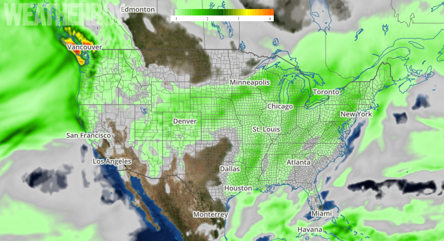
A wet weather pattern will impact much of the United States in the coming days. Heavy rain will impact northern California, Oregon, and Washington while soaking rains also extend far north up the Northeast coast as cold air retreats into Canada there. Over the next 5 days, more than seven inches of rain will fall on the northern half of the West Coast; more than a foot of rain is possible in the rain forests of the Washington coast. Conditions will also be soggy in the northeast, with 1-2″ of rain expected from New Jersey north to Maine.
Two systems of note will be responsible for this wet weather, with a significant winter storm developing over the central United States tomorrow and a potent area of low pressure coming on shore the Pacific Northwest.
The significant winter storm in the central United States will move from southwest to northeast this week, bringing rain and milder conditions up the northeast. A well-defined cold front and its associated area of precipitation will
continue to push southeast into the southwestern US today. A vast area spanning from the Sierra Nevadas, northern Arizona and northward to the Rockies in Colorado will have a mix of rain and snow today, turning to mostly snow by
this evening and through Sunday. The heaviest snow accumulations will likely occur over the mountains of southwest Wyoming, Utah and eastern Nevada this afternoon. As this front progresses eastward, so will the heaviest precipitation. Locally heavy snow is forecast for the central and southern Rockies. An area of low pressure is expected to strengthen over the southern High Plains tonight and then track northeast into Midwest. In the cold sector, an expansive area of snow will span from the Rockies into the central High Plains by tonight, reaching the Upper Midwest on Sunday. Snowfall intensity will be moderate to heavy at times and accompanied by gusty winds there. Further south and ahead of the low’s trailing cold front, expect showers and thunderstorms to develop, increasing in coverage and intensity across eastern Oklahoma and Texas into the mid and lower Mississippi valley Sunday afternoon and evening. This system will eventually pass north and east into the Great Lakes region, departing the country near Quebec, Canada. Soaking rains will spread up the coastal plain in the Northeast, eventually bringing plain rain to all of New England by Tuesday night. As that system departs, colder but drier air will filter back into the northeast for the mid-week.
Meanwhile, the Pacific Northwest will be home to a significant rain and elevation snow maker. A couple of fronts will pass through the Northwest, spreading widespread rain and mountain snow as it heads toward the Intermountain West. Heavy snow will be possible for portions of the Cascades over the next few days. Temperatures will be near or below normal across the western states. Some of that precipitation will be heavy, with the National Weather Service’s Weather Prediction Unit calling for over a foot of rain near Olympic National Park.
Another coastal system is expected to impact the Pacific Northwest during the middle to later part of the week, bringing another round of heavy precipitation there.
While the pattern is wet, it isn’t very white, especially in the Eastern United States. With storm systems likely to move up the Mississippi River Valley into the Ohio River Valley and Great Lakes region rather than along the coast, this pattern supports more milder air further up the northeast coast. With a surge of mild air arriving before these storm systems are able to cool the area, rain instead of snow will be the dominant precipitation type for the foreseeable future. No significant change in the pattern is expected through to the end of January.
