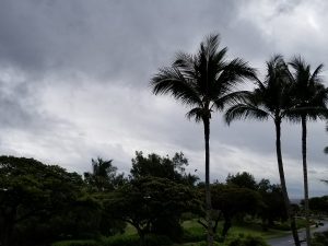
The National Weather Service office in Honolulu, Hawaii continues Winter Storm Warnings for the higher elevations of the Big Island of Hawaii today as a Kona Low moves through the Aloha State.
A Kona Low is a storm more typical of the winter weather season in the Pacific and is formed with winds coming from a westerly direction. In the Hawaiian language, “Kona” typically refers to the western side of the Island. (It is also the name for Hawaii Island’s largest city on the western side, Kona.) These cold-core, extratropical cyclones often bring numerous days of hazardous weather to the entire island state. Hazards can include extremely heavy tropical downpours which cause flash floods, landslides, rockslides, and mudslides. Other hazards include large hail, damaging wind gusts, and rough, potentially destructive surf.
Kona Lows also produce something that Hawaii isn’t generally known for: heavy snow. While images of palm trees and poolside cocktails with umbrellas are the first thoughts that come to mind about outdoor life in Hawaii, the state’s highest elevations often will get snow in the winter months. Kona Lows produce some of the heaviest snows in Hawaii.
This week’s Kona Low is no exception to the heavy snow: 6″ or more is expected on the Big Island summits and upper slopes today. In addition to heavy snow, damaging winds in excess of hurricane force are expected; the National Weather Service warns that southwest to west winds of 55-65mph are likely with gusts over 75mph. In past Kona Low storm systems, winds have exceeded 100mph. Heavy snow with strong winds will lead to poor visibility below 1/4 mile. Due to the severe winter weather, the Mauna Kea Summit road has been closed by local officials today.
Here are photographs of other Hawaii snowstorms we’ve captured.
While heavy snow will accumulate on Hawaii’s Big Island, flooding rains are a problem elsewhere in the state, with considerable flooding an issue on parts of Oahu and Maui.