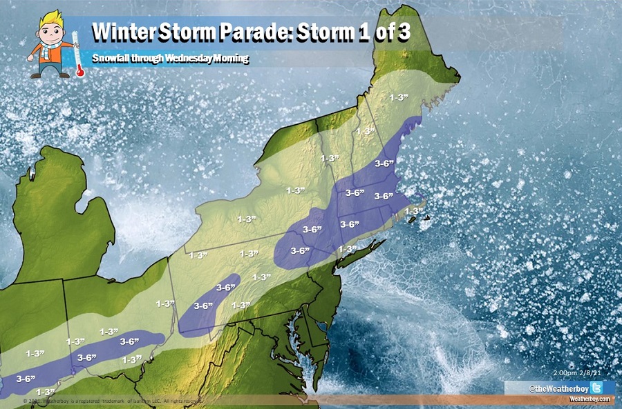
A winter storm parade of sorts will visit portions of the eastern United States in the coming days, with three systems over the next 7 days likely to add to the growing snowpack there. The first system will move through late tonight into tomorrow and exit the coast by Wednesday morning while the next system will move into the Mid Atlantic by Wednesday afternoon. That system could linger through Friday before clearing the coast. The third potential system could impact the Mid Atlantic and the Northeast on Sunday afternoon.
With accumulating snow likely across tomorrow, the National Weather Service has extended Winter Weather Advisories that are in effect across Missouri, Illinois, and Indiana to portions of Ohio, Pennsylvania, and New York; more are likely to be issued across southern New England later today.
While this system will bring a broad area of 1-3″ snow with some pockets of 3-6″ possible, especially over southern New England, it’ll also bring light rain to areas just south of there like Philadelphia and New York City. Precipitation should be light and should be absorbed by the existing snowpack.
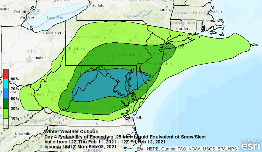
The next system will slide into the Mid Atlantic late Wednesday as an area of low pressure evolves through the region for the balance of the work week. The best time for accumulating snow from this system appears to be Thursday, with the greatest threat of the most snow over portions of eastern West Virginia, northern Virginia, and much of Maryland and Delaware. Included in this area are the cities of Washington, DC and Baltimore, MD which could see some of the higher totals from this storm. Unlike past systems that brought snow to the north, the northern edge of this precipitation should be suppressed to around / near I-80 in Pennsylvania and New Jersey. As a result, New York City would be on the northern edge of this system.
The third system appears to be a coastal storm that would take shape off the Mid Atlantic coast and move north into New England by Sunday afternoon. It is too soon to say what kind of precipitation will fall from that storm or how much will fall, but the potential exists for not only heavier precipitation, but wind and coastal flooding threats too.
