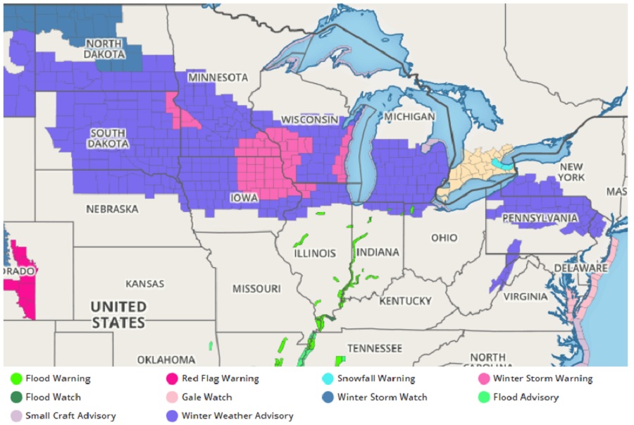
The National Weather Service has issued Winter Storm Warnings and Winter Weather Advisories for portions of the upper Plains, Great Lakes, and Northeast, with advisories stretching from North and South Dakota east to northern New Jersey. The advisories have been posted in advance of the next winter storm due to impact these regions. But like past weather events this winter, this storm will fail to regenerate into a substantial coastal storm in the East, keeping the chance of significant snow in the Northeast near the I-95 corridor away.
An upper level wave pushing across the Plains and into the Midwest will aid the organization of an eastward moving frontal system and continue to spread snow from the Northern and Central Plains into the Great Lakes and into the central/northern Appalachians by Friday. The highest chances for locally heavier snow of 6″+ will be over eastern Iowa into southern Wisconsin on Thursday, and favorable lake-effect locations off Lake Erie and into higher elevations of the central/northern Appalachians in Pennsylvania into Friday. Snow rates may exceed an 1″ per hour at times, leading to difficult travel conditions.
Precipitation chances will also increase for the Mid-Atlantic and Carolinas due to the approaching frontal system on Friday. Light to moderate rain showers can be expected from Virginia south, while some snow may mix in to the north along the I-95 urban corridor Friday night, though very little to no accumulations are currently expected. Temperatures will generally cool going into the weekend following the frontal passage. High temperatures on Friday will be in the 30s and 40s for New England and 50s-60s in the Mid-Atlantic, cooling down to the 40s and 50s for much of the East Coast on Saturday.
