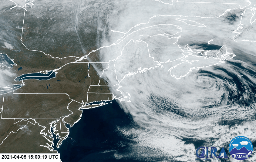
A system spinning about off of the northeast coast is creating some interesting forecast scenarios as its caught in the eyes of the computerized tropical forecast models.
The Atlantic Hurricane Season doesn’t begin until June 1, but that doesn’t mean storms can’t form beforehand. Tropical cyclones have formed in the Atlantic in April in previous years, although they’re rare and always on the weak side:
- April 14-16, 1912 – Tropical Depression
- April 20, 1962 – Tropical Depression
- April 18-21, 1973: Tropical Depression
- April 21-24, 1992: Subtropical Storm
- April 20-24, 2003: Tropical Storm Ana
- April 19-21, 2017: Tropical Storm Arlene
Both the ECMWF and the GEFS computer forecast models suggest a tropical depression with winds of at least 23 mph will form here, with the ECMWF giving 95%+ odds of a system forming over the next 24-72 hours.
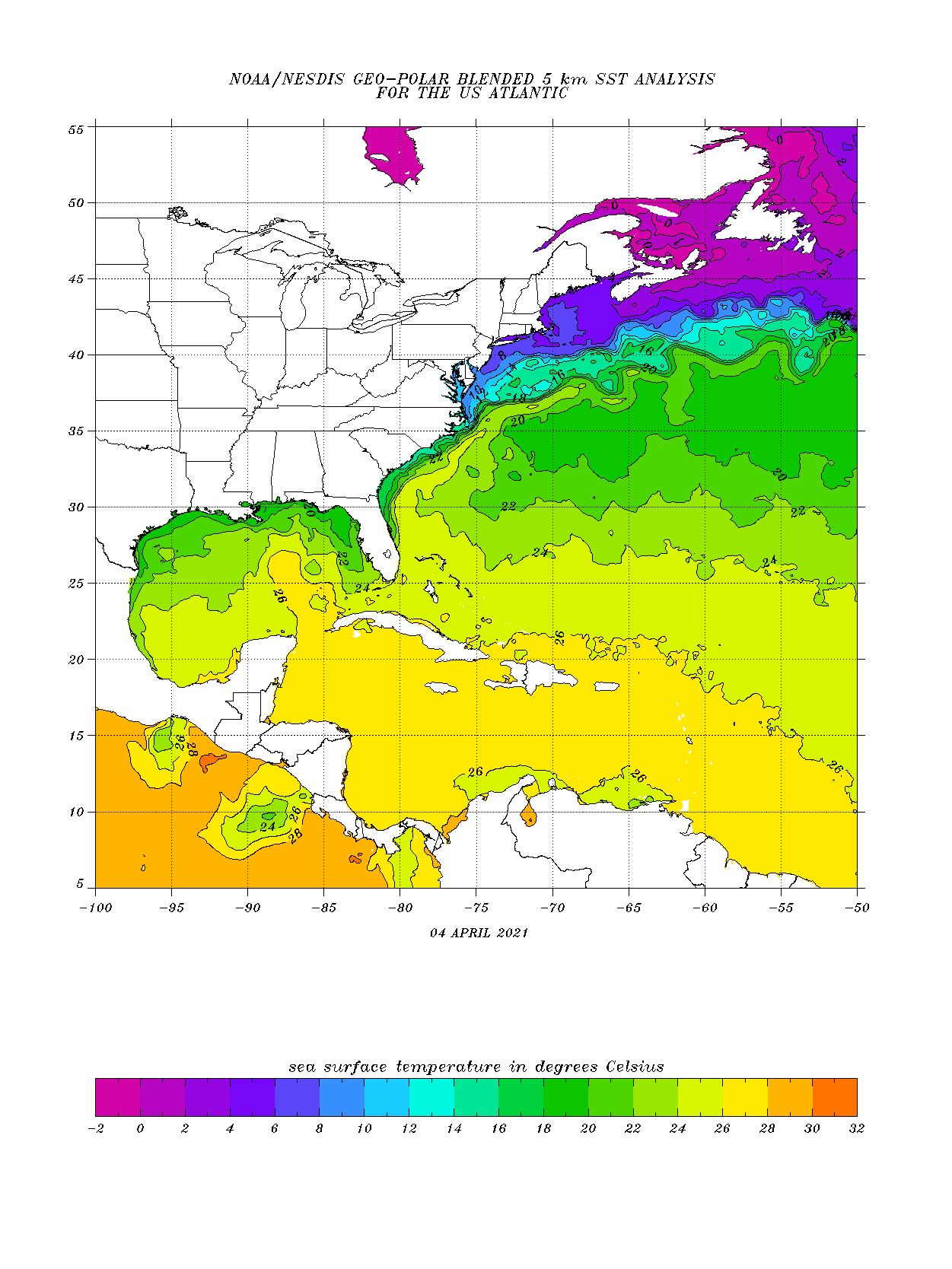
Appearing as a swirl of clouds on satellite imagery, the storm system lacks deep convection and isn’t located in an area of warm water that could help development. However, a subtropical system could take shape here over time.
After bringing the system closer to the southwest coast of Nova Scotia, computer forecast guidance curves the storm south and east away from the U.S. Northeast Coast and away from the southeast coast of Canada. By the end of the week, it could become a large area of low pressure and bring heavy rain and gusty winds to Newfoundland and Labrador.
The National Hurricane Center (NHC) hasn’t issued any statements about this disturbance. Earlier this year, the NHC announced they would begin issuing Tropical Outlooks on May 15, 2 weeks before the start of the traditional hurricane season. Should a tropical cyclone take shape prior to May 15, the NHC would issue relevant products even during the off-season.
