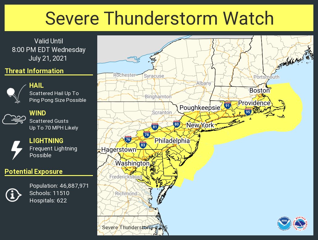
A summertime of severe thunderstorms and flooding rains continues in portions of the northeast, with yet another severe weather event unfolding in an area hit hard by floods, damaging storms, and tornadoes in recent weeks. Due to the threat of severe weather today, the National Weather Service has issued a Severe Thunderstorm Watch for all of New Jersey, Delaware, and Rhode Island, much of eastern Maryland and Massachusetts, much of Connecticut, southeastern Pennsylvania including the Philadelphia Metro area, Washington, DC, and southeastern New York including all of Long Island and the New York City metro area. This watch, which impacts a population of more than 46 million people, is in effect through 8pm tonight.
Within the severe thunderstorm watch area, beyond localized flooding rains and frequent lightning, large hail up to ping pong size is possible. Damaging wind gusts, which could reach 70 mph in places, are also possible in the stronger thunderstorm cells. An isolated tornado or two also can’t be ruled out.
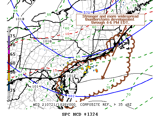
According to the National Weather Service’s Storm Prediction Center (SPC), portions of central and southern New Jersey, Delaware, eastern Maryland, eastern Connecticut and Massachusetts, and all of Rhode Island could see especially intense storms between 4-6 pm today. The SPC says that the eastward progression of the mid-level trough, slow southeastward advancement of the cold front and influence of convective outflow associated with early thunderstorm development have increasingly confined stronger boundary-layer instability to the Delmarva Peninsula, southern New Jersey and portions of southeastern New England, focusing on an area south of the the cold front into pre-frontal surface troughing, where stronger thunderstorm development is expected to continue to increase and tend to consolidate.
People in these areas are advised to keep an eye to the sky and be on alert should Severe Thunderstorm Warnings or Tornado Warnings be issued for their community.
