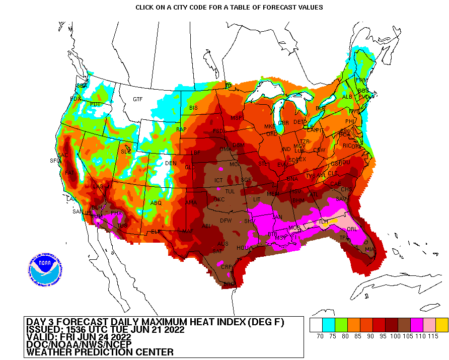
A blast of extreme summertime heat is coming to portions of the eastern U.S. later this week, with heat indexes over 110° likely in portions of the southeast. Florida will see the worst of the heat, with readings of 120° possible across the northern part of the panhandle.
A strong upper ridge in conjunction with surface high pressure over the southeast are responsible for driving this latest heatwave. For now, northerly clockwise flow around these features continues ushering in unseasonably dry air while large-scale subsidence suppresses convection to allow unimpeded late- June sunshine to prevail. This leads to an increase in temperatures as highs climb into mid-upper 90s today. However, the lower humidity keeps max heat indices closer to 100, which is below advisory criteria the National Weather Service uses to issue heat-related advisories.
Over the next few days, the ridge will sharpen its grasp over the southeast, with places like Tallahassee, Dothan, Marianna, Albany and Valdosta all expected to come in with high temperature readings over 102. Even coastal locations such as Panama City and Apalachicola could see the century mark. The last time Tallahassee recorded triple digits was on September 18, 2019.
On Thursday, the heat wave will intensify, challenging record high readings in the process. Albany and Tallahassee are expected to break 105 for a daytime high. The current records which could be broken include 105 in Tallahassee (set on June 11, 2015), 107 in Albany (set on July 15, 1980), 105 in Dothan (set on July 2, 2009), 106 in Valdosta (set on June 15, 2011), and 105 in Marianna (set on June 15, 2011.)
On Thursday and Friday, the humidity will return with the dangerously hot air temperatures; the heat index is expected to exceed 110 and could even reach 120 in places.
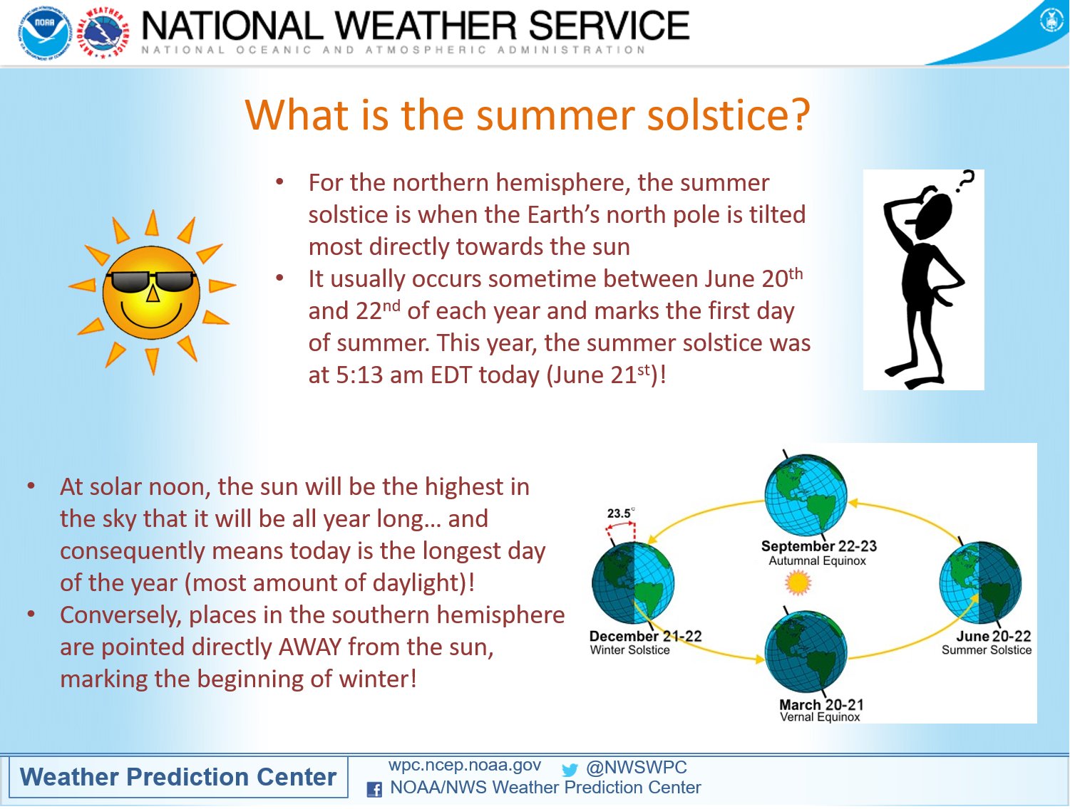
The extreme heat is arriving just a few days after the Summer Solstice, which is today. The summer solstice is when the Earth’s north pole is tilted most directly towards the sun; it usually happens sometime between June 20 and 22 each year. This year, the summer solstice arrived at 5:13 am ET, marking it the first day of summer.
