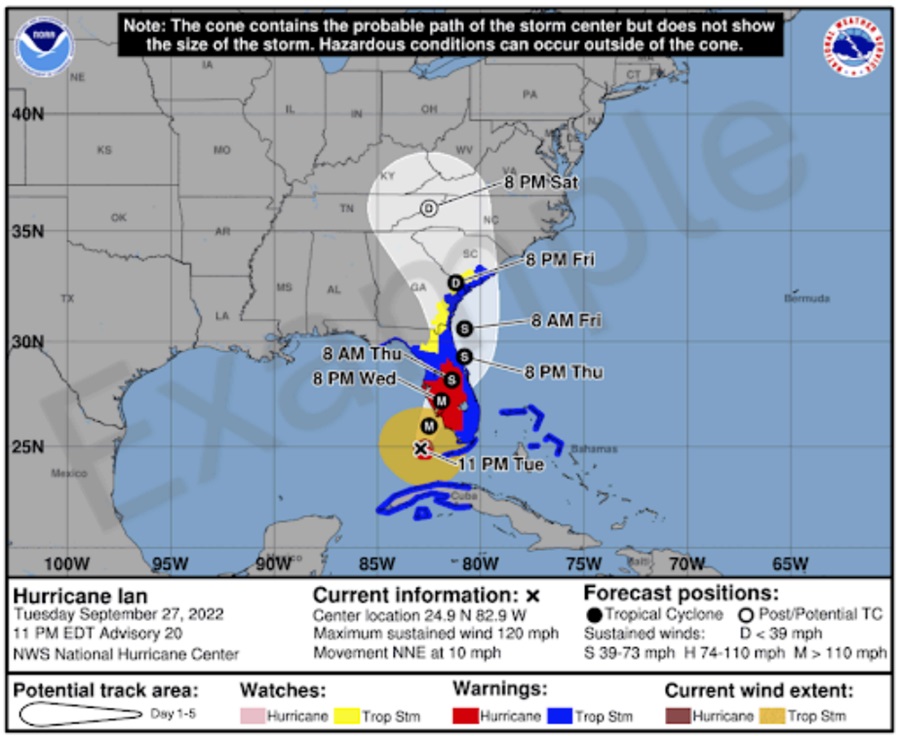
The National Hurricane Center (NHC) announced their plans to release a new forecast cone this summer when tropical cyclones threaten the United States. While the 2024 Atlantic and Central Pacific Hurricane Seasons begin on June 1, the NHC says their updated cones won’t be out until mid-August.
“Recommendations from social science research suggest that the addition of inland watches and warnings to the cone graphic will help communicate inland wind risk during tropical cyclone events while not overcomplicating the current version of the graphic with too many data layers,” the National Hurricane Center said in a statement. “There will be opportunities to provide feedback during the product’s experimental phase. Owing to the experimental nature of the graphic, it may not be available as soon as the current operational cone graphic due to the time needed to compile complete inland watch and warning information, but should generally be available within 30 minutes of the advisory release.”
Because this updated cone will be considered experimental, the National Hurricane Center will continue to release the forecast cone they always have. That could change in future seasons as they review feedback.
This new experimental version will add a depiction of tropical storm and hurricane watches and warnings over inland areas in the continental United States. Previously, the cone graphic only showed watches and warnings in a line along the coastline of the affected area. In addition, the experimental version of the cone will use white transparent shading for the entire 5-day forecast, instead of using white stippling for the 4-5-day portion of the forecast and the entire outline of the cone will be in white.
The watch and warning depiction will be predominant on the graphic, therefore watches and warnings in effect for land areas will take precedence over the cone.
This new experimental cone will only be issued when a tropical cyclone threatens the U.S.; there will be no changes to the operational cone with respect to how international coastal watches and warnings are displayed.
The NHC is also reviewing additional social science research on the cone of uncertainty and gathering feedback from customers and partners to evaluate other potential modifications to the product, “customers” being members of the public, government agencies, and everyone that uses their forecasts and maps. The NHC said, “The primary goal is to find ways to simply and effectively communicate tropical cyclone risk without making the graphic too complicated.”