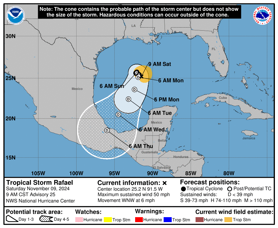
After drifting around in the Gulf of Mexico since crossing western Cuba, it now appears Rafael, once a Category 3 hurricane on the Saffir-Simpson wind scale but now a tropical storm, will move south and hit Mexico in the coming days. There are no coastal storm watches or warnings up at this time for Rafael. However, deep moisture from the storm system is advancing north towards the Texas/Louisiana border where heavy rain is expected to continue to fall.
As of the latest advisory from the National Hurricane Center (NHC), Rafael was about 290 miles north-northwest of Progreso, Mexico and had maximum sustained winds of 50 mph. Minimum central pressure was up to 999 mb or 29.50″.
Rafael is moving toward the west-northwest near 6 mph now, but the NHC says the storm is expected to slow down and meander over the central Gulf of Mexico Sunday into Monday, then turn toward the south or south-southwest by Monday night. Continued weakening is forecast through early next week.
Swells generated by Rafael will continue impacting portions of the northern and western Gulf Coast through the weekend. These swells are likely to cause life-threatening surf and rip current conditions.
Rainfall indirectly associated with the moisture from Rafael is expected to lead to 3-6″ of rain, with local amounts to 10″, across portions of the Upper Texas Coast into Southwest and Central Louisiana through Sunday morning. This rain will lead to potentially significant flash flooding.