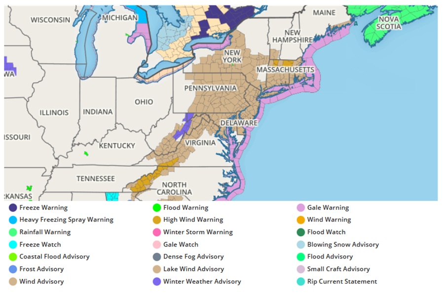
A damaging wind event is likely to unfold across portions of the Northeast and along the spine of the Appalachian Mountains, prompting the National Weather Service to issue High Wind Warnings and Wind Advisories for a large area. The worst of the winds will strike between 3pm and midnight this evening.
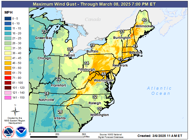
Colder and drier air is arriving across the East today, creating some areas of snowfall downwind of the Great Lakes and into the central and northern Appalachians. But the quick moving cold and dry air is rushing in, setting the stage for a widespread wind event. Northwest winds from 15 to 25 mph will gust from 40 to 50 mph later today and tonight. The National Weather Service warns that gusty winds will blow around unsecured objects, tree limbs could be blown down, and a few power outages may occur as a result of the winds.
While the worst of the winds should diminish by midnight, Friday is expected to be another breezy day across the northeast. Wind gusts up to 40 mph, and possibly higher are possible through the day on Friday. A tight pressure gradient will remain in place and several computer forecast models are depicting the low and mid level jet over or near the northern Mid Atlantic through much of the day.
“We will be watching trends through the day very closely,” the National Weather Service said in a forecast discussion, suggesting additional wind advisory products may be needed for tomorrow too over some parts of the northeast.