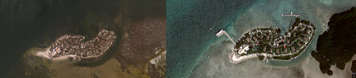
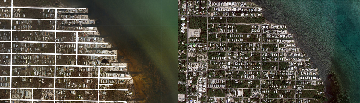
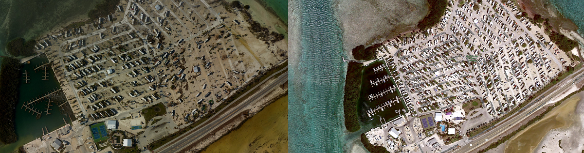
Heartbreaking images are now available online, showing a complete picture of the destruction the Florida Keys saw as a result of Major Hurricane Irma. A team of NOAA aviators have been taking a series of high-resolution aerial images of the entire length of the Keys; these images are a crucial tool in determining the extent of the damage inflicted by storms and flooding. Staff from NOAA’s Office of Marine and Aviation Operations and NOAA’s National Geodetic Survey capture these images using specialized remote-sensing cameras aboard NOAA’s King Air and Twin Otter aircraft flying above the area at an altitude between 1,640 and 4,921 feet. After the images are processed and stitched together, NOAA posts them online for the public to access.
According to NOAA, by comparing the aerial imagery collected with baseline coastal datasets, response agencies can assess any damage to major ports and waterways, coastlines, critical infrastructure and coastal communities. This can help maintain or restore safe navigation and prioritize areas in need. In addition, imagery is used for ongoing research efforts to test and develop new airborne digital imaging standards.
The first images shared were of Key West, showing substantial superficial damage for the most part. Subsequent photo releases showed more and more extensive damage further up the keys, with more substantial damage in the middle keys near Marathon. The final images, released the night of September 13, show the hardest hit areas where Major Hurricane Irma slammed into Cudjoe Key as a Category 4 hurricane on the Saffir-Simpson wind scale.
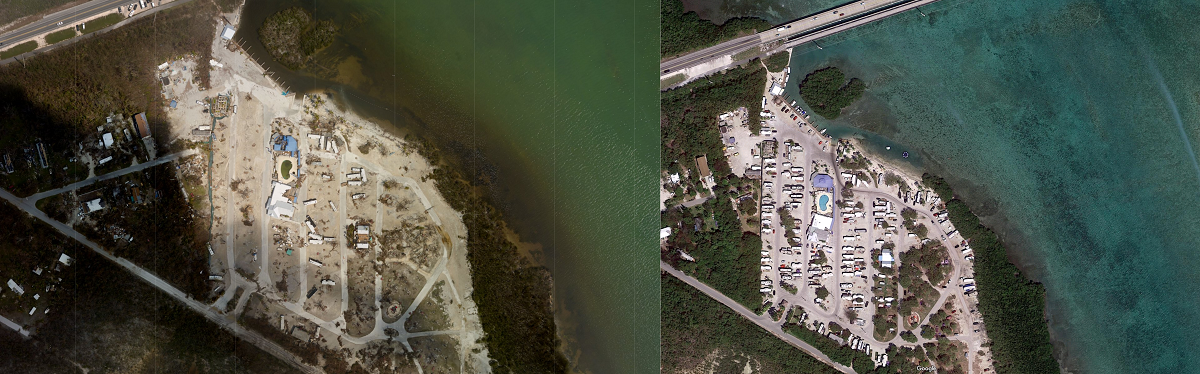
The images show entire mobile home communities washed away while sturdy single family homes were destroyed or badly damaged. Campgrounds, such as the Sugarloaf Key West KOA Holiday, and resorts, such as luxury resort Little Palm Island, lay awash in ruins and sand.
NOAA has an online interactive viewer where you can review the images snapped on multiple passes through the Keys; you can also toggle back to baseline imagery captured before Irma’s arrival to contrast the scenery before and after impact. The address for viewing the images is here: https://storms.ngs.noaa.gov/storms/irma/index.html
