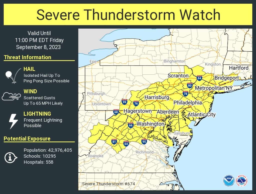
Another round of severe weather is impacting portions of the I-95 corridor around and between Washington DC and New York City, prompting the National Weather Service’s Storm Prediction Center to issue a Severe Thunderstorm Watch for the region. The watch, now in effect through 11 pm tonight, includes Delaware, Washington DC, most of New Jersey and Maryland, northern Virginia, portions of eastern West Virginia, eastern and southeastern Pennsylvania, southern New York include the New York City metro area and western Long Island, and portions of southwestern Connecticut. The cities of Philadelphia, Baltimore, and Bridgeport are including in the watch.
According to the National Weather Service, while tornadoes are unlikely, frequent lightning is likely. Damaging wind gusts up to 65 mph and isolated hail up to ping pong ball size is also possible within this watch area.
If today’s weather sounds a lot like yesterday’s, it’s because it is. Thunderstorms this afternoon through early evening will again be capable of damaging winds and hail, in a scenario somewhat similar
to yesterday. Midday observations continue to suggest that abundant insolation east of the Appalachians, combined with a pervasive plume of 60s to low 70s F surface dew points, will yield a pronounced area of enhanced atmospheric instability ripe for thunderstorm development.
Scattered thunderstorms are expected to develop from near the West Virginia/Virginia border northeast into parts of eastern New England. With forecast soundings suggesting nearly unidirectional southwest flow will weaken with height from the mid to upper-levels, multicell clustering will dominate today’s severe weather outbreak. Strong upper level winds will help create clusters of storms today from New York to Maine. Steeper low-level lapse rates from Virginia to the Delaware Valley should compensate for the weaker flow and support relatively more prolific downburst potential. Scattered damaging winds along with isolated severe hail are expected regionally, mainly from mid-afternoon into evening.
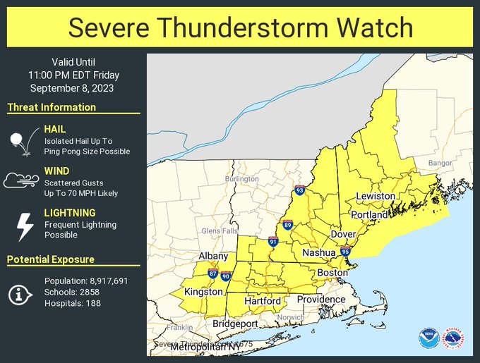
Due to the clusters of storms expected in the northeast between New York and Maine, an additional Severe Thunderstorm Watch has been issued for that area too.

While there’s a risk of more scattered showers and storms in the northeast tomorrow, they shouldn’t be as widespread nor as severe as today’s storms.