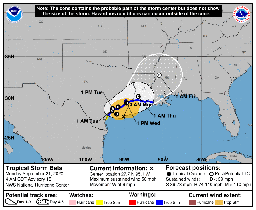
The extraordinarily slow-moving Tropical Storm Beta continues its westward creep to Texas today. While the storm appears to be losing strength quickly, it is still forecast to bring more heavy rain to the Lone Star State over the next 48 hours.
Satellite imagery shows that much of the deep convection associated with Beta has dissipated while data from the Air Force Hurricane Hunters indicate that the winds have decreased. While Beta is hanging onto tropical storm status, it should finally move into Texas after soaking the region for many days.
After landfall tonight, the models differ on how far inland Beta gets over Texas, but the majority of the guidance shows the cyclone stalling just inland on Tuesday in weak steering currents. The combination of an approaching shortwave trough and an amplifying ridge over Florida should cause Beta to turn northeastward along or near the Texas coast late Tuesday and Wednesday, and then farther inland over Louisiana on Thursday. Steady weakening
is forecast after landfall, but heavy rains are still expected.
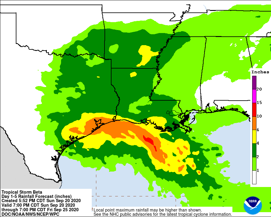
The expected slow motion of Beta will produce a long duration rainfall event from the middle Texas coast to southeast Louisiana. Flash, urban, and minor river flooding is likely. Rainfall will also spread northward into the ArkLaTex region and east into the Lower Mississippi Valley and portions of the Southeast through the end of the week. Flash, urban, and isolated minor river flooding is possible there too.
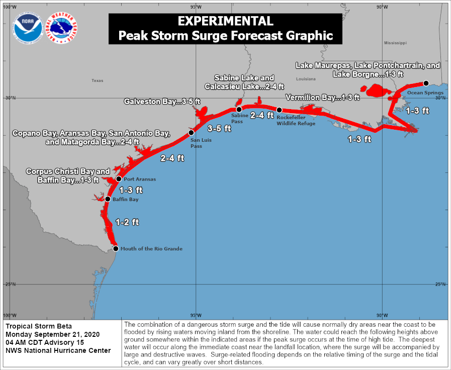
While Beta is losing its punch, there continues to be the danger of life-threatening storm surge near times of high tide through Tuesday along portions of the Texas and Louisiana coasts within the storm surge warning areas.
Tropical-storm-force winds will spread westward across the Texas coast later this morning and continue into Tuesday. In addition to gusty winds, there’s also a threat of isolated tornadoes as the storm makes its way into Texas and Louisiana.
