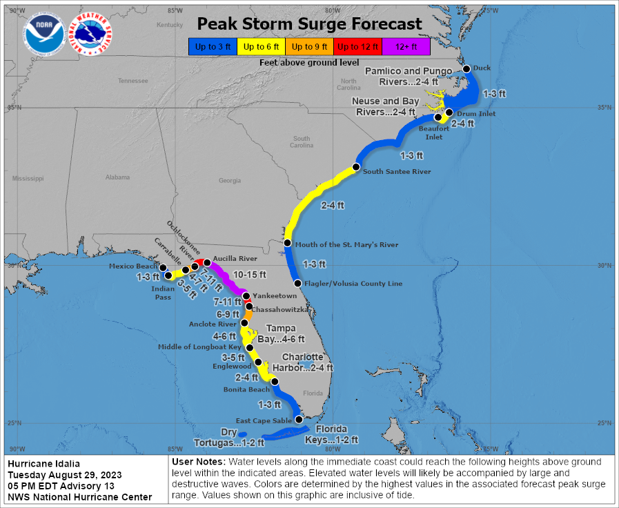
A catastrophic storm surge is expected upwards of 10-15′ as Hurricane Idalia makes landfall on Florida’s Gulf Coast, according to the National Hurricane Center in Miami, Florida.
“Catastrophic impacts from storm surge inundation of 10 to 15 feet above ground level and destructive waves are expected somewhere between Aucilla River and Yankeetown, Florida,” the National Hurricane Center said in key messages released at 5 pm ET. “Life-threatening storm surge inundation is likely elsewhere along portions of the Florida Gulf Coast where a Storm Surge Warning is in effect. Residents in these areas should follow any advice given by local officials.”
In addition to an epic storm surge, destructive winds are also likely. “There is the potential for destructive life-threatening winds where the core of Idalia moves onshore in the Big Bend region of Florida, with hurricane conditions expected elsewhere in portions of the Hurricane Warning area along the Florida Gulf Coast,” the National Hurricane Center warned. “Strong winds will also spread inland across portions of northern Florida and southern Georgia near the track of the center of Idalia where Hurricane Warnings are in effect. Residents in these areas should be prepared for long-duration power outages.

The National Hurricane Center also warns that hurricane-force winds are also possible in portions of eastern Georgia and southeastern South Carolina where Hurricane Watches are now in effect.
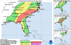
In addition to surge and wind, very heavy rain will also fall across the southeastern United States. Areas of flash, urban, and moderate river flooding are expected across the Florida Big Bend, central Georgia and South Carolina, and through eastern North Carolina later tonight into Thursday.
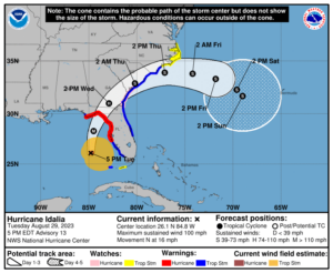
Idalia, now a category 2 hurricane with 100 mph winds, is located about 195 miles southwest of Tampa, Florida and about 300 miles south of Tallahassee, Florida. The storm is moving north at 16 mph while it’s minimum central pressure is down to 972 mb or 28.71″.
Many warnings and watches are in effect. Right now, a Storm Surge Warning is in effect for the area from Englewood northward to Indian Pass, including all of Tampa Bay. A Hurricane Warning is in effect for the area from the Middle of Longboat Key northward to Indian Pass, including Tampa Bay. A Tropical Storm Warning is in effect for Dry Tortugas, Florida, the area from Chokoloskee northward to the Middle of Longboat Key, the area west of Indian Pass to Mexico Beach, and along the U.S. East Coast from Sebastian Inlet, Florida to Surf City, North Carolina. A Storm Surge Watch is in effect for Bonita Beach north to Englewood, including Charlotte Harbour, from the mouth of the St. Mary’s River to South Santee River, South Carolina, across Beaufort Inlet to Drum Inlet in North Carolina, and the for the Neuse and Pamlico Rivers in North Carolina too. A Hurricane Watch is in effect from the Mouth of the St. Mary’s River to Edisto Beach, South Carolina. A Tropical Storm Watch is in effect for the Lower Florida Keys west of the west end of the Seven Mile Bridge and for the area north of Surf City, North Carolina to the North Carolina/Virginia state border. A Tropical Storm Watch is also in effect for the Pamlico and Albemarle Sounds.

Each advisory has a different meaning. A Hurricane Warning means that hurricane conditions are expected somewhere within the warning area. Preparations to protect life and property should be rushed to completion. A Storm Surge Warning means there is a danger of life-threatening inundation, from rising water moving inland from the coastline, during the next 36 hours in the indicated locations. A Tropical Storm Warning means that tropical storm conditions are expected somewhere within the warning area. A Storm Surge Watch means there is a possibility of life-threatening inundation, from rising water moving inland from the coastline, in the indicated locations during the next 48 hours. A Hurricane Watch means that hurricane conditions are possible within the watch area. A Tropical Storm Watch means that tropical storm conditions are possible within the watch area, generally within 48 hours.
The National Hurricane Center warns that additional warnings will likely be required tonight or on Wednesday.
The National Hurricane Center has refined its forecast for the storm. A northward to north-northeastward motion is expected through tonight, with Idalia’s center forecast to reach the Big Bend coast of Florida on Wednesday morning. After landfall, the center of Idalia is forecast to turn toward the northeast and east, moving near or along the coasts of Georgia, South Carolina, and North Carolina late Wednesday and Thursday.
Additional strengthening is forecast by the National Hurricane Center and Idalia is expected to become a major hurricane tonight before it reaches the Big Bend coast of Florida. Idalia is likely to still be a hurricane while moving across southern Georgia, and possibly when it reaches the coast of Georgia or southern South Carolina on Wednesday.
Hurricane-force winds extend outward up to 25 miles from the center and tropical-storm-force winds extend outward up to 160 mile.