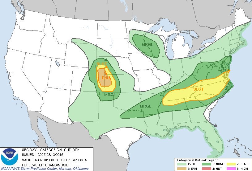
Thick clouds responsible for hiding the peak of the Perseid Meteor Showers are also helping kill a severe weather threat that was expected today. The National Weather Service’s Storm Prediction Center has refined their Convective Outlook for today, reducing the threat level of severe weather expected for much of the Mid Atlantic.
Based on latest satellite, radar trends, and observations, the severe weather threat continues to shift south today according to the National Weather Service. While there’s a slight chance of severe storms later this afternoon, anything that becomes severe should be very localized.
While the severe weather threat has greatly diminished, the threat of heavy rain hasn’t. As such, the National Weather Service continues to have flood-related advisories up for portions of the Mid Atlantic now.
The cloud cover is also impacting temperatures today. As a result of the extensive cloud cover, especially toward the northern Mid Atlantic and New England, forecast high temperatures for today were lowered in much of the region. However, with abundant moisture around, it’ll still feel very muggy with dewpoints reaching into the low to mid 70s across the Mid Atlantic.