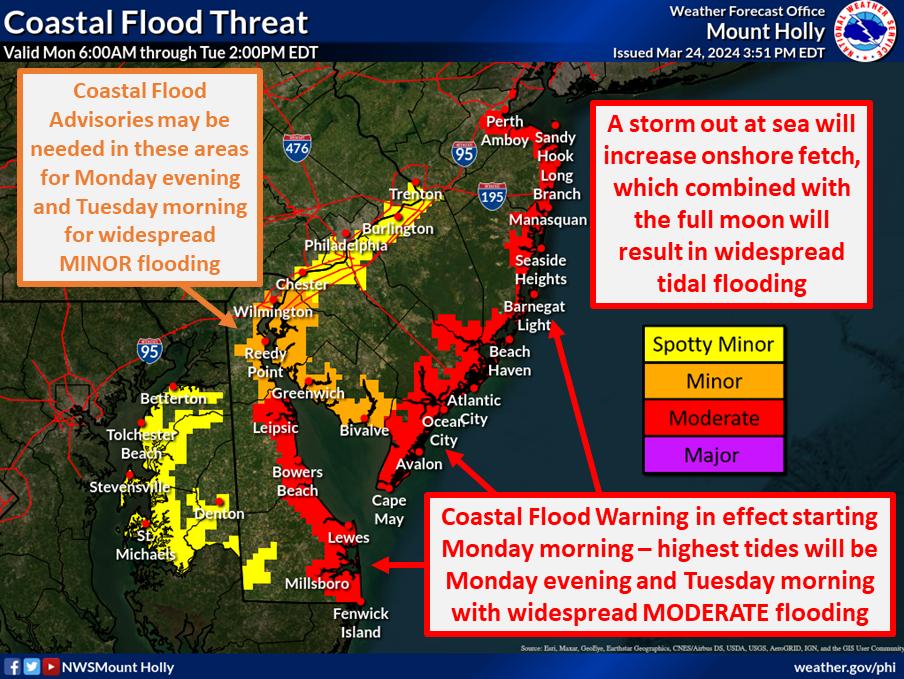
An area of low pressure well off the U.S. East Coast isn’t close enough to create rain or wind problems on land, but it is close enough to create a coastal flood threat, especially around portions of New Jersey and Delaware into Tuesday.
The storm system responsible for this persistent coastal flood threat is driving an extended duration of long period swells and rough surf impacting the Atlantic coast. Surge values of 2-3 feet were initially expected by tonight by the National Weather Service, but have not been nearly so high. As such, the National Weather Service says they “forced tidal forecasts downward across the board and replaced all the warnings with advisories given the poor performance to this point.”
While conditions weren’t as bad as initially expected today, the threat of coastal flooding will persist into Tuesday. According to the National Weather Service, widespread minor flooding still looks likely across most of the Mid Atlantic except for the Tidal Delaware River and Chesapeake Bay shore. This threat could persist through midnight Tuesday night.
Compared to the forecast along the ocean front and bay shore, forecasts have been underdoing water levels along the tidal Delaware River, and its possible we may need to expand coastal flood advisories north up the river. “This may be due to increase inflow from the recent heavy rains,” the National Weather Service hypothesizes on these high water levels. “Additionally, the bottling of water up at the mouth of the Chesapeake may be holding water in there, and that may be increasing the minor flood risk across our portions of the bay as we head into Wednesday.”
The National Weather Service continues to urge caution, saying, “turn around, don’t drown; never drive through flood waters.”
