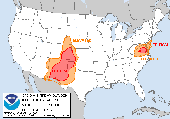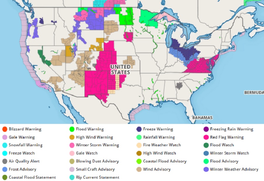
According to the National Weather Service’s Storm Prediction Center (SPC), there are elevated and critical fire weather risks across portions of the West and the Mid Atlantic, prompting the National Weather Service to issue Red Flag Warnings for many states including New Jersey, Delaware, Maryland, Virginia, West Virginia, South Dakota, Nebraska, Colorado, Texas, Kansas, Oklahoma, New Mexico, and Arizona.
The National Weather Service said a variety of ingredients are coming together in these zones to increase the threat of wildfire. Dry surface conditions with relative humidity levels in the low 20%’s were being observed along with westerly surface winds near 20 mph. The SPC warns, “Current trends lend higher confidence in widespread elevated and critical conditions developing this afternoon over mostly receptive fuels. Fire-weather concerns will likely continue into this early evening before wind slacken and humidity recovers.

The National Weather Service is monitoring two primary areas of concern, each with their own concerning fire weather ingredients coming together.
Downslope of the Rockies, a variety of factors are to blame for the increased fire threat there. A mid-level trough will approach the Plains while a second trough ejects into the Atlantic today. Surface low development is likely across the central High Plains, with a dryline poised to advance eastward across western Kansas into the Texas Panhandle. Behind the dryline, 20+ mph sustained westerly surface winds amid 15% relative humidity will promote widespread Critical conditions from central New Mexico/Colorado into southwest Kansas and the Oklahoma/Texas Panhandles. Along and immediately ahead of the dryline, an isolated thunderstorm or two may develop from southwestern Kansas into northwestern Texas. Any storms that can develop should be high-based, and a couple of dry strikes are possible immediately after initiation before storms can mature. Lightning strikes without rain increase the threat of fires.
Across the Mid Atlantic, a corridor of dry westerly surface winds appear likely this afternoon from eastern West Virginia to the Atlantic Seaboard given the passage of a surface lee trough. Within the area of Critical concern, surface wind speeds are expected to reach 15 mph amid 20-30% relative humidity for at least a few hours where fuels are dry enough to support wildfire-spread.
The combination of low fuel moisture, low relative humidity, and gusty winds may contribute to the enhanced spread of fires in the Red Flag Warning zones. A Red Flag Warning means that critical fire weather conditions are either occurring now or will shortly due to a combination strong winds, low relative humidity, and dry fuels. Any fires that develop may quickly get out of control and become difficult to contain. Because of that threat, those in Red Flag Warning areas are encouraged to follow fire safety advice from local officials; this may mean no outdoor campfires, BBQs, or even smoking.
For more more information about wildfire danger, burn restrictions, and wildfire prevention and education, the National Weather Service encourages residents to visit their state forestry or environmental protection websites.