A vigorous cold front forecast to push through the U.S. East Coast Sunday into Monday will bring about many hazards including damaging wind gusts, strong to severe thunderstorms, flooding rains, coastal flooding, and even heavy snow. According to the National Weather Service, “forecaster confidence in a potent cold front impacting the region towards the end of the weekend is high.
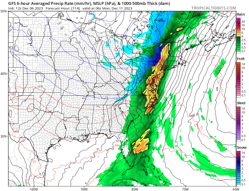
An occluding surface cyclone west of the Great Lakes region Thursday night into Friday is forecast to have a new cyclone develop southwards of it west of the Mississippi River Valley. This new surface cyclone is expected to strengthen and move northeastwards with time, having a fair amount of frontogenesis occur with it. By Saturday night, the strengthening surface low will draw a potent set of fronts closer to the East Coast. The warm front will look to lift through to southern New England by late Saturday night into Sunday while the potent cold front will reach the coast by Sunday night.
With a strong front drawing near and looking to cross through, and surface high pressure off to the east, a strong pressure gradient will likely take hold over the Northeast on Sunday morning. This gradient will only increase in magnitude with time into Sunday night. Winds by Sunday afternoon will likely be 30-40 mph near the I-95 corridor from Virginia to Massachussetts, with gusts of 40-55 mph possible in coastal areas starting in the afternoon and lasting into Sunday night. Due to these wind speeds and the damage they may create, the National Weather Service could issue wind-related advisories ahead of the storm’s arrival.
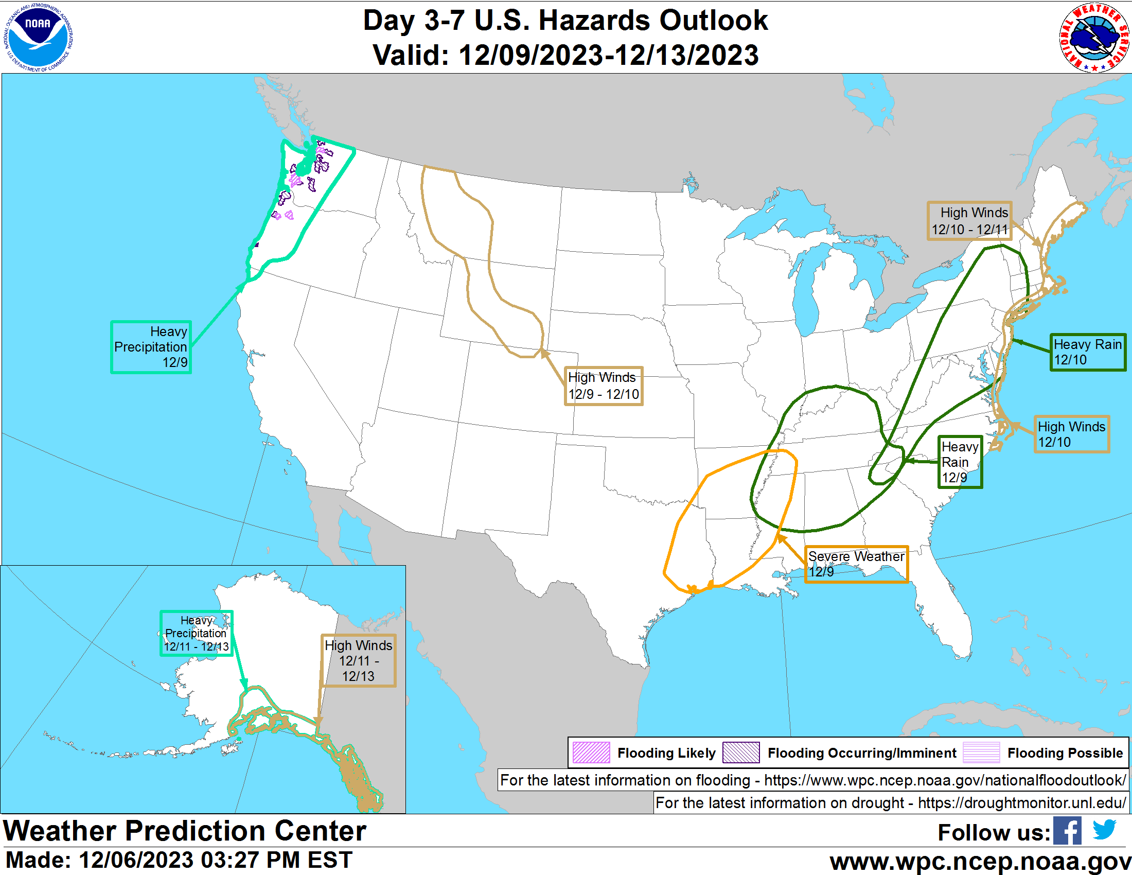
The threat of thunderstorms will be greatest late Sunday night into early Monday morning. Storms may produce isolated large hail or tornadoes; the greatest risk factor will be from damaging winds though.
While snow won’t be an issue in the I-95 corridor with this system, snow is possible in central and northern New York state and interior New England. With cold air advection expected later Sunday overnight into Monday morning on the backside of the storm system, it is possible that there may be a transition to snow on the backside, especially across the higher terrain just north and west of the I-95 corridor. Recent computer forecast guidance solutions have trended slightly farther southeast with the wave of low pressure that develops along the front; this would result in a snowier and cooler solution, especially across interior central and northern New England.
