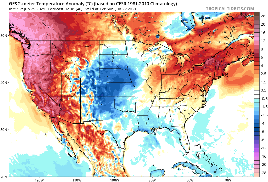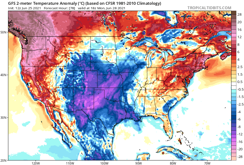
Dangerous heat will bake the northwest and northeast in the coming days, creating a serious situation and desperate need to cool down. Today in the Pacific northwest, the mercury will climb more than 25 degrees above normal to readings into the 90s and low 100’s even near the Canadian border. Temperatures over 110 are also possible in interior Washington and Oregon. On Monday, while the northwest continues to bake, the northeast will also heat up, with temperatures in the high 90s in places like Maine and New Hampshire. Major cities to the south on each coast will also see hot readings, with metro regions around Los Angeles, San Diego, New York City, and Philadelphia all seeing excessive heat.

The United States isn’t alone with oppressive heat. Portions of eastern Europe and western Asia are also seeing extreme heat, with many record highs being shattered there. Narva, Estonia as an example hit their record high of 94 today, the hottest reading ever for June.

Places in the U.S. that don’t usually see such high temperatures will have unique problems. As an example, the National Weather Service office in Seattle, Washington warns that significant impacts are possible on snow & glaciers in the mountains during & after this heatwave. “Mountaineers should avoid prolonged exposure to large overhead hazards like seracs and hanging glaciers. These large overhead hazards can release at any time, day or night, and can produce destructive icefall avalanches that can run long distances,” they warn. They add, “hot temperatures will cause rapid snow melt and holes to open up in snow fields. Crevasse bridge collapses and serac falls on glaciers will be possible.” According to their office, water rushing thru snowpack can last for several days past peak heating, so these hazards can linger. “Be prepared & hike with caution if you’re heading out into next week.”
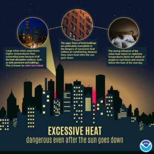
Heat will also hit urban centers in the east and the west, which brings about additional challenges even after the sun goes down. Large buildings made of heat-absorbing surfaces like steel and concrete combined with dark pavement and parking lots creates a heat island effect, where temperatures can be several degrees warmer in the urban environment versus the less dense suburbs. These urban heat islands also are slow to release their heat at night, keeping dangerously warm conditions around long after the sun sets.
The National Weather Service recommends these heat wave safety tips:
- Slow down. Strenuous activities should be reduced, eliminated, or rescheduled to the coolest time of the day. Individuals at risk should stay in the coolest available place, not necessarily indoors.
- Dress for summer. Lightweight light-colored clothing reflects heat and sunlight, and helps your body maintain normal temperatures.
- Put less fuel on your inner fires. Foods (like proteins) that increase metabolic heat production also increase water loss.
-

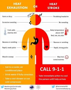
People should know the difference between Heat Exhaustion and Heat Stroke. Image: National Weather Service Drink plenty of water or other non-alcohol fluids. Your body needs water to keep cool. Drink plenty of fluids even if you don’t feel
thirsty. Persons who (1) have epilepsy or heart, kidney, or liver disease, (2) are on fluid restrictive diets or (3) have a problem with fluid retention should consult a physician before increasing their consumption of fluids. - Do not drink alcoholic beverages.
- Do not take salt tablets unless specified by a physician. Persons on salt-restrictive diets should consult a physician before increasing their salt intake.
- Spend more time in air-conditioned places. Air conditioning in homes and other buildings markedly reduces danger from the heat. If you cannot afford an air conditioner, spending some time each day (during hot weather) in an air conditioned environment affords some protection.
- Don’t get too much sun. Sunburn makes the job of heat dissipation that much more difficult.