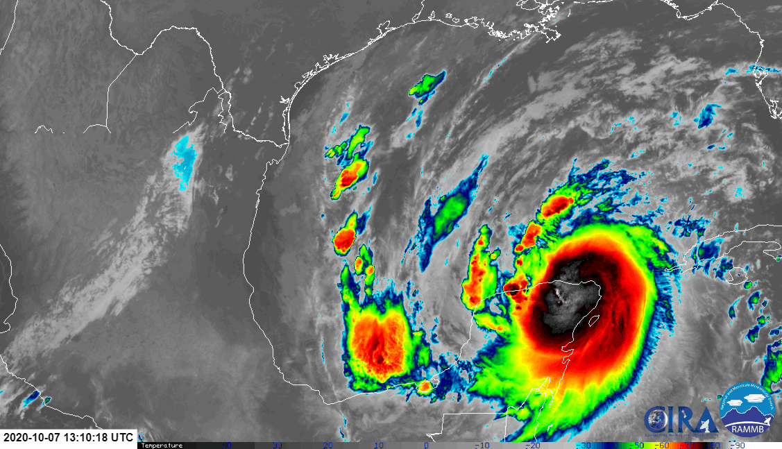
With Hurricane Delta becoming better organized and stronger, time is running out for the U.S. central Gulf Coast to prepare for the impacts of the season’s latest tropical cyclone. Hurricane Warnings and Storm Surge Warnings are up, giving people ample warning of the impending danger. While Hurricane Delta is gaining strength now, it may weaken slightly as it strikes land. However, it will still be a very powerful and potentially lethal storm when it arrives.
A life-threatening storm surge is expected near and east of where Delta makes landfall on Friday, and a Storm Surge Warning is in effect from High Island, Texas, to Ocean Springs, Mississippi. The highest inundation of 7 to 11 feet is expected somewhere between Rockefeller Wildlife Refuge and Port Fourchon, Louisiana. The National Hurricane Center says residents in the warning area should promptly follow advice given by local officials. The storm surge risk remains high despite the forecast decrease in intensity before landfall since Delta is expected to grow in size.
Hurricane-force winds are expected Friday afternoon and evening somewhere within the Hurricane Warning area between High Island, Texas, and Morgan City, Louisiana. Hurricane-force winds will also spread inland across portions of southern Louisiana near the path of Deltas center Friday evening and Friday night. Winds in the impact area will be strong enough to damage or destroy many structures, especially those built with older, outdated construction codes or other mobile housing, such as mobile homes, trailers, and tiny homes.
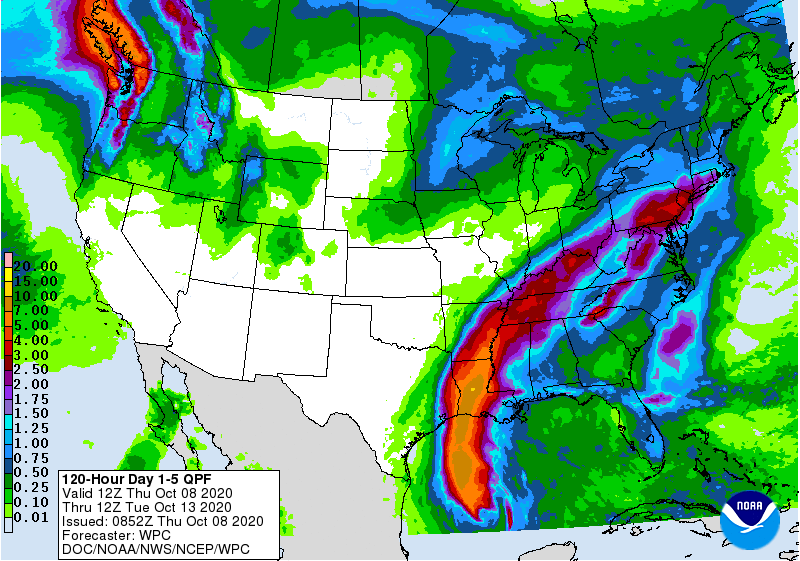
Significant flash flooding and minor to moderate river flooding are likely in parts of Louisiana Friday and Saturday, with additional flooding in portions of the central Gulf Coast into the Lower Mississippi Valley. While a foot or more of rain could fall in portions of Louisiana, heavy rain will extend into the Ohio Valley and eventually the Mid Atlantic over time; places like New Jersey and Pennsylvania could also see excessive rain from this system.
