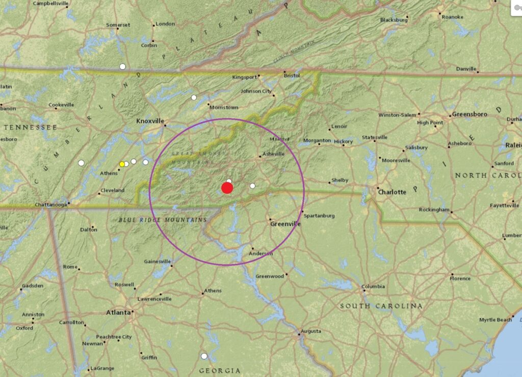
A weak earthquake rattled western North Carolina today, not far from where another earthquake shook the Blue Ridge Mountains just 9 days ago . According to USGS, at 3:05 am, a magnitude 1.6 event struck from a shallow depth of 0.1 km near Glenville, North Carolina. The quake, which struck northwest of Greenville, South Carolina, due west of Chattanooga, Tennessee, and northeast of Athens, Georgia. The earthquake was too weak to generate any damage or injuries.
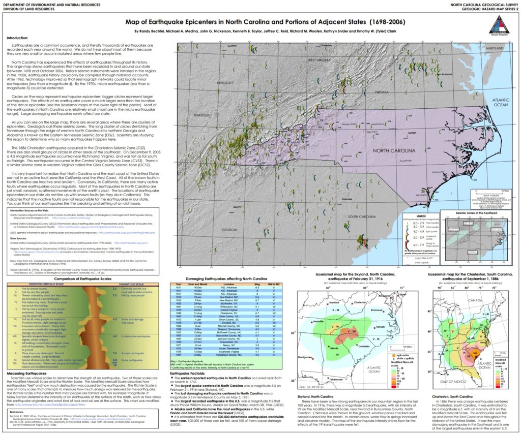
According to the North Carolina Department of Environmental Quality, while North Carolina is no stranger to earthquakes, large, damaging earthquakes are rare. Large, damaging seismic events are rare and the few felt in North Carolina had epicenters outside of the state. Most quakes in North Carolina originate from the East Tennessee seismic zone to the west, the Charleston, South Carolina seismic zone to the south, or the Central Virginia seismic zone to the north. The most common and strongest earthquakes to strike the state have been in the western part along the Appalachian Mountains.
The North Carolina Department of Environmental Quality (DEQ) cautions that people in the state should be prepared for the possibility of larger quakes. “Although strong earthquakes here in North Carolina are infrequent, proper construction techniques need to be followed. An earthquake of magnitude 5 or greater could block major transportation routes in the mountains and cause structural damage elsewhere,” the DEQ writes. They add, “Many of the larger earthquakes in North Carolina occurred when the state was more rural. Recent development includes buildings and infrastructure such as road and power networks. Modern building codes take into account the possibility of an earthquake but many older buildings were not constructed to withstand violent shaking.”