• Skip to primary navigation
  • Skip to main content
  • Skip to primary sidebar

Weatherboy

Weatherboy Weather News, Maps, RADAR, Satellite, and Forecasts.

  • Local
  • Earth Science News
  • RADAR
  • Current Warnings
  • Satellite
  • Current Maps
  • Forecast Maps
  • Video

Earthquake Rattles Central North Carolina Between Greensboro and Charlotte

by Weatherboy Team Meteorologist - April 17, 2026

The earthquake's epicenter was at the orange dot inside the colored concentric circles on this map. Image: USGS
The earthquake’s epicenter was at the orange dot inside the colored concentric circles on this map. Image: USGS

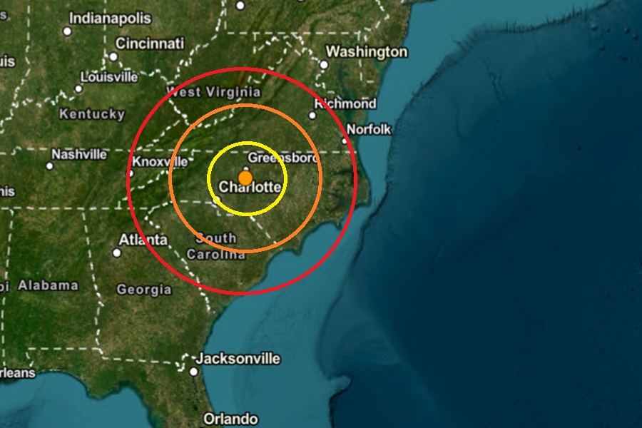
According to USGS, a relatively weak earthquake rattled North Carolina today between Greensboro and Charlotte. The 8:45 pm earthquake struck from a depth of 9.2 km near the town of Randleman and was rated by USGS as a magnitude 2.0 event. There were no reports of any damage nor injuries.

Today’s earthquake is near where a pair of quakes struck on April 5.

According to USGS, earthquakes with a magnitude of 2.0 or less are rarely felt or heard by people, but once they exceed 2.0 , more and more people can feel them. While damage is possible with magnitude 3.0 events or greater, significant damage and casualties usually don’t occur until the magnitude of a seismic event rises to a 5.5 or greater rated event.


While the U.S. West Coast is best known for their earthquakes, there is considerable earthquake risk elsewhere in the country. Image: USGS
Noteable earthquakes in North Carolina from 1874-Present. Image: North Carolina Department of Environmental Quality

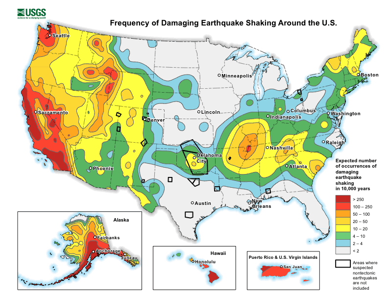
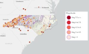
Earthquakes are not common in North Carolina, but they do occur, with most being small and not causing damage. While the state isn’t known for frequent or strong seismic activity, occasional tremors can be felt, and some larger earthquakes have been recorded in the past. While the mountains and foothills of western North Carolina are not located along an active tectonic plate boundary, the region still has minor earthquakes linked to old fault lines along the Appalachian Mountains.

According to the North Carolina Department of Environmental Quality, while North Carolina is no stranger to earthquakes, large, damaging earthquakes are rare. Large, damaging seismic events are rare and the few felt in North Carolina had epicenters outside of the state. Most quakes in North Carolina originate from the East Tennessee seismic zone to the west, the Charleston, South Carolina seismic zone to the south, or the Central Virginia seismic zone to the north.  The most common and strongest earthquakes to strike the state have been in the western part along the Appalachian Mountains.


Primary Sidebar

Sponsored Ad

Search

Latest News

  • National Weather Service Looking to Fill Hundreds of Meteorology Jobs
  • USGS Expects Volcano to Erupt Any Moment; Volcano Watch in Effect
  • USGS Closely Three U.S. Volcanoes; Issues Alert
  • Northeast Chill Prompts Frost/Freeze Advisories
  • Large Hail Threat Over Texas
  • From Arthur to Wilfred: 2026 Atlantic Hurricane Storm Names Unveiled
  • South Carolina Shakes from Fresh Earth Quake
  • Western Snow Drought Bad
About | Careers | Contact | Contests
Terms | Privacy | Ad Choices
Weatherboy is a (R) Registered Trademark of isarithm LLC, All Rights Reserved.
All content herein is Copyright by Isarithm LLC 1997-2022

Insert/edit link

Enter the destination URL

Or link to existing content

    No search term specified. Showing recent items. Search or use up and down arrow keys to select an item.