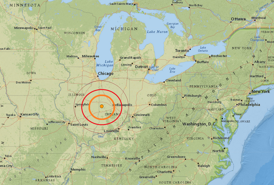
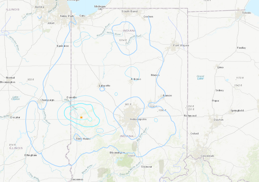
A potent 3.8 earthquake rocked central Indiana today. The quake struck around 2:18 pm or 3:18 pm 2 miles west of Bloomingdale; Indiana has two time zones and the earthquake was felt across both. It was felt throughout a wide area of Indiana and Illinois, including the Chicago metro area. The earthquake’s epicenter is roughly 130 miles south of Chicago. There are no reports of damage or injuries.
The last time an earthquake this strong hit the area was in December 2010, when a 3.8-magnitude quake rattled parts of Indiana, Illinois and Michigan. Two years earlier in 2008, a 5.2-magnitude earthquake shook Mount Carmel, Illinois and was felt in Indiana too.
The earthquake was centered at about 4.8 miles deep into the Earth.
Indiana lies near two major fault lines: the Wabash Valley Seismic Zone, which lies along the southwestern Indiana and southeastern Illinois borders, and the New Madrid Seismic Zone, which runs through western Kentucky and southeastern Illinois. The New Madrid Seismic Zone, also referred to by some as the New Madrid Fault Line, is a major seismic zone and a prolific source of intraplate earthquakes within the tectonic plate that the continental United States resides on.
The New Madrid fault system was responsible for a series of destructive earthquakes that struck in 1811 and 1812. The first major earthquake struck on December 16, 1811 as a magnitude 7.5 quake. A few hours later, a strong 7.0 earthquake struck the region too. On January 23, 1812, a 7.3 earthquake struck and another 7.5 occured on February 7, 1812.
While it isn’t known whether or not today’s quake is a precursor to something larger, a larger earthquake will inevitably strike the area at some point in the future. In a report filed in November 2008, FEMA warned that a serious earthquake in the New Madrid Seismic Zone could result in “the highest economic losses due to a natural disaster in the United States,” further predicting “widespread and catastrophic” damage across Alabama, Arkansas, Illinois, Indiana, Kansas, Kentucky, Mississippi, Missouri, Oklahoma, Texas, and particularly Tennessee, where a 7.7 magnitude quake would cause damage to tens of thousands of structures affecting water distribution, transportation systems, and other important infrastructure. Such a strong earthquake is expected to also result in many thousands of fatalities, with more than 4,000 of the fatalities expected in Memphis, Tennessee alone.
