A spring weather system is forecast to bring severe weather that’s been impacting the Midwest today to the East tomorrow. A low pressure system is forecast to intensify and track relatively quickly northeastward across the central Plains this evening and into the upper Midwest by Monday morning.
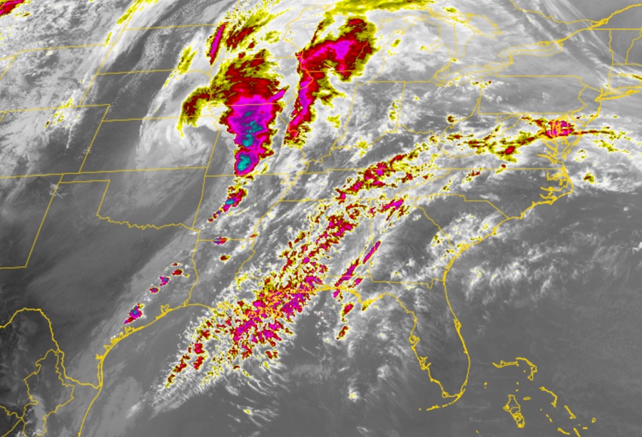
A swath of heavy rain accompanied with gusty winds and a slight chance of flash flooding is expected to develop ahead of the system from Arkansas today into Missouri, and eastern Iowa tonight, along with strong to possibly severe thunderstorms.
The Storm Prediction Center has issued an enhanced risk of severe thunderstorms from northern Arkansas into much of Missouri through Monday morning. The hazards associated with these thunderstorms are frequent lightning, severe thunderstorm wind gusts, hail, along with the possibility of tornadoes.
The low pressure system is forecast to expand in size as it moves across the Great Lakes on Monday before moving away into Canada later into Tuesday.
Colder air wrapping around the system is enough to bring a period of wet snow across the upper Great Lakes near the west end of Lake Superior early on Monday where a few inches of accumulation is possible. The low will then bring gusty winds and scattered showers through the central Great Lakes on Monday.
The trailing cold front associated with this low will sweep across the Ohio and Tennessee Valleys on Monday with thunderstorms gradually losing intensity. The front will then bring scattered showers and embedded thunderstorms Monday night through the Northeast with only a slight chance of showers on Tuesday.
Across the Deep South, the chance of scattered showers and thunderstorms will linger into Tuesday as the front gradually stalls across the region.
