34 earthquakes rattled Hawaii’s Big Island today, home to Mauna Loa, the world’s largest active volcano. A 3.2 magnitude earthquake struck Pahala, south of Mauna Loa’s summit, this evening at 8:08 pm local time, 2:08 am ET. Mauna Loa is not erupting at this time, but the U.S. Geological Survey (USGS) is urging people to prepare for the possibility of an eruption at some point in the future. None of today’s earthquakes was strong enough to generate any tsunami.
Much of the earthquakes on Hawaii Island weren’t noticeable today, although the most recent earthquake has been reported by at least 14 people to USGS within 10 minutes of striking. A 3.0 earthquake that struck near the same location during the afternoon also garnered attention and USGS submissions to their “Did you feel it?” database.
Other earthquakes over a 2.5 magnitude around Hawaii’s Big Island include a 2.8 earthquake that struck west of Kailua-Kona at dinner time, local time, and a 2.5 with an epicenter just north of Honoka’a on Hawaii Island’s north coast.
In a recent news release, Hawaiian Volcano Observatory (HVO) scientists with USGS cautioned, “While an eruption of Mauna Loa is not imminent, now is the time to revisit personal eruption plans. Similar to preparing for hurricane season, having an eruption plan in advance helps during an emergency.”
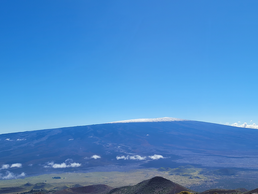
Mauna Loa is considered the largest active volcano on Earth, rising to 13,681 feet above sea level. Mauna Loa rises up from the ocean floor of the Central Pacific at a depth of about 3 miles. Because of the volcano’s significant mass, the ocean floor directly beneath Mauna Loa is depressed by another 5 miles. According to USGS, this places Mauna Loa’s summit about 56,000 feet above its base; the enormous volcano covers half of the island of Hawaii, also known simply as the “Big Island of Hawaii.”
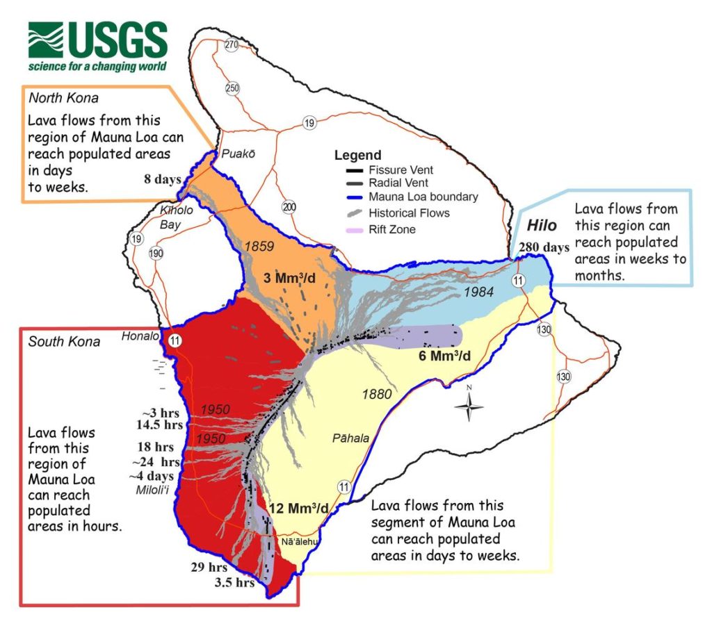
Mauna Loa eruptions tend to produce voluminous, fast-moving lava flows that can impact communities on the east and west sides of the Big Island from Kona to Hilo. Since the 1850s, Hilo in eastern Hawaii has been threatened by 7 Mauna Loa lava flows. On the south and west sides of the island, Mauna Loa lava flows have reached the coast there 8 times: in 1859, 1868, 1887, 1926, 1919, and three times in 1950.
According to USGS, while Mauna Loa is not erupting right now , rates of deformation and seismicity remain elevated above long-term background levels. GPS measurements continue to show slow, long-term summit inflation consistent with magma supply to the volcano’s shallow storage system. A slight increase in the rate of inflation that began in January continues.
Last week, more than 225 earthquakes rocked Mauna Loa. However, most were magnitude 2.5 or less and most were below the summit. The strongest earthquake in the last 7 days occurred in Pahala, registering as a 4.2 magnitude event on Wednesday afternoon. There have been more than 660 earthquakes on Hawaii Island in the last 30 days and more than 6,800 in the last 365 days.
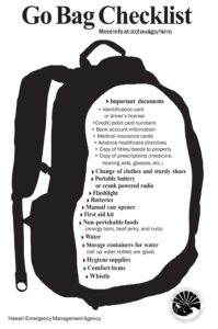
With another eruption on Mauna Loa inevitable, although the timing is not yet defined, the USGS is urging people on Hawaii to have a personal response plan, prepare a “go bag”, and determine what one would do in the event of an eruption at different times of the day or week.
“The most important thing you can do is to have a personal response plan,” says the USGS. Document what you’d do when a volcano erupts and make sure your family and friends are aware of what that plan is.
USGS suggests getting a “go bag” in order. “Nowadays, people pack “go” bags containing essential items in case you have to leave your house under an evacuation order. You may want to include important documents, like your birth certificate, deeds, legal papers, and medications.”
USGS says people in Hawaii should develop plans that factor in different types of days and time of day: if family members are at work or school at specific times, the plan should address what people should do and how they should communicate if an eruption occurs when people aren’t home. USGS says, “It is useful to also have a communication plan, so you can be in touch with those you care about.”
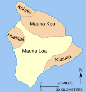
Mauna Loa is one of 5 volcanoes that make up Hawaii’s Big Island. The oldest volcano on Hawaii Island is Kohala, which is more than one million years old. Kilauea is the youngest, at an estimated 300,000-600,000 years old. Mauna Loa is the second youngest volcano on the island, estimated to be about 700,000 years old.
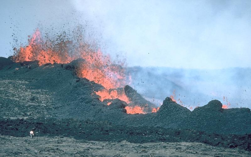
Mauna Loa is a shield volcano with long, broad slopes that fall off into the ocean. Lava eruptions from Mauna Loa are very fluid and are typically non-explosive. Magma for Mauna Loa and Kilauea, the latter which has been erupting since December, is sourced from a hot spot in the middle of the Pacific Plate. Because the plate is slowly drifting, Mauna Loa will eventually move away from the hotspot, become an extinct volcano in the next 500,000-1,000,000 years.
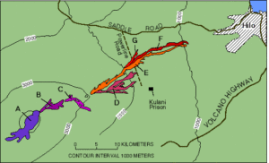
Mauna Loa’s most recent eruption occured from March 24 to April 15 in 1984. Lava from the 1984 flow spilled over near the summit while additional fissures drove flows in the general direction of Hilo. The flows stopped roughly 4 miles outside of Hilo’s city limits. No lava has flowed from Mauna Loa since.
While scientists are certain Mauna Loa will erupt, they aren’t exactly sure when yet or where lava will flow from the next eruption. Previous flows impacted the communities of Puako and Waikoloa Beach on the northwest coast, Kailua-Kona and Captain Cook on the west coast, Milolii and Ocean View on the southwest coast, and Hilo on the east coast. Because of the wide range of impacts in past eruption events, the USGS is encouraging people island-wide to prepare for the possibility of volcanic activity. Beyond the hazards of fast moving lava flows, there could be toxic volcanic gasses and a volcanic haze known as vog, as well as fall-out of volcanic debris such as ash or volcanic glass.
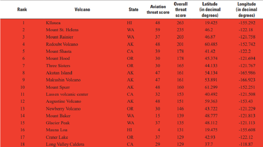
Hawaii also doesn’t have a monopoly on volcanic threats in the United States. While USGS rated Kilauea as the biggest volcanic threat in the U.S. in its updated 2018 list of volcanic dangers, Mauna Loa is only 16 on the list. Washington’s Mount St. Helens and Mount Rainer, Alaska’s Redoubt, California’s Mount Shasta, and Oregon’s Mount Hood and Three Sisters are considered to be even more dangerous.
