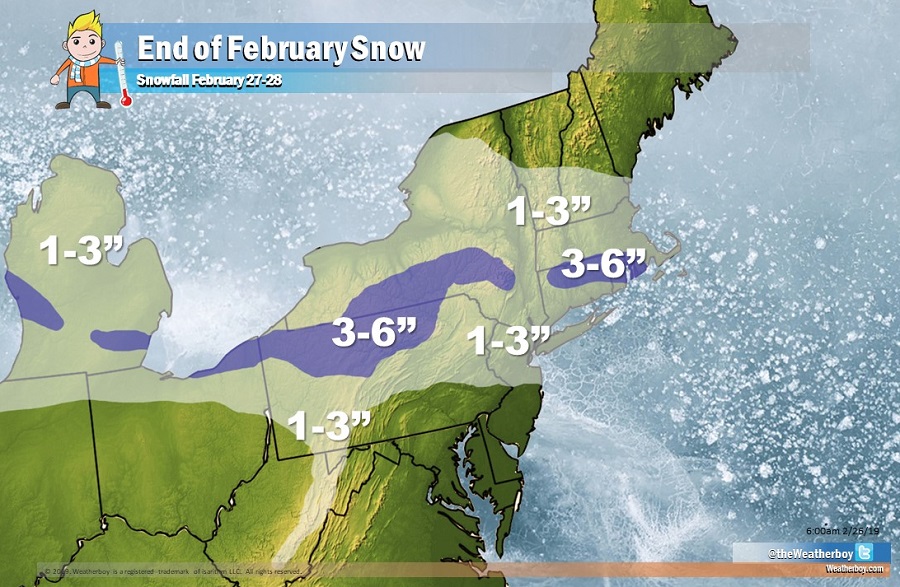
A weather system is forecast to bring a round of light to moderate snow to portions of the Great Lakes and Northeast as the month of February comes to an end.
A shortwave trough is responsible for the light snow threat. The trough will pass quickly through New England late Wednesday and early Thursday. This shortwave will bring some light precipitation to the northeast, from central Pennsylvania and New Jersey north. An analysis of thermodynamic profiles indicate that this precipitation will fall as all snow, especially along and north of the I-95 corridor. Some light rain/snow showers, perhaps mixed with sleet at times, may be possible south of I-95, mainly across far southern New Jersey, Wednesday evening. The most widespread snowfall should move through late Wednesday afternoon and evening. Snow should end from west to east before daybreak Thursday morning.
Snow from this system will be light. We expect little/no accumulation south of I-276 and I-76 in Pennsylvania and I-195 in New Jersey. North of there, 1-3″ could fall. 3-4″ could fall over portions of Michigan, northeastern Ohio, near the New York/Pennsylvania border, and in portions of Connecticut and Rhode Island.
The low pressure responsible for this light snow will head out to sea on Wednesday, allowing high pressure to return briefly for Thursday. On Friday, another shortwave is forecast to move through the region, with another shot of light snow possible then in the same area in the first days of the new month.