Tropical Storm Erin formed today in the central Atlantic ocean and is forecast to become a major hurricane in the coming days as it approaches North America. Where it eventually ends up is still not known and the National Hurricane Center is urging people all around the Atlantic Hurricane Basin to be prepared for its arrival or the arrival of any tropical cyclone this season.
“It is still too early to determine what impacts, if any, Erin may bring to the northern Leeward Islands, Bermuda, or the east coast of the United States,” said the National Hurricane Center in their latest update. “As we approach the climatological peak of the hurricane season, it is an opportune time to ensure your preparedness plans are in place.”
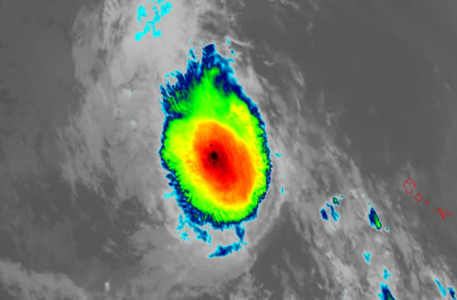
Erin is currently located about 430 miles west-northwest of the Cabo Verde Islands and about 2,155 miles due east of the Northern Leeward Islands. Maximum sustained winds are 45 mph while the minimum central pressure is down to 1004 mb or 29.65″.

The National Hurricane Center says Erin is moving toward the west near 21 mph and this motion is expected to continue for the next several days with a gradual slowdown in forward speed. Gradual strengthening is forecast over the next several days and Erin could be at hurricane intensity by the latter part of this week. The official forecast brings it to “Major Hurricane” status by Saturday afternoon which means its maximum sustained winds will be at least 115 mph.
Global computer models have been conflicted with the eventual path this storm may take. Some runs/models have brought the storm into the Gulf of America, others bring it to Florida or the U.S. East Coast, and others steer it away from the U.S. safely.
Whether or not Erin ultimately impacts the United States, residents still need to brace for the worst of hurricane season. Typically the peak of the Atlantic Hurricane Season is around September 10 and meteorologists with NOAA and Colorado State University that make the leading seasonal outlooks for the tropics continue to call for an above-normal season.
