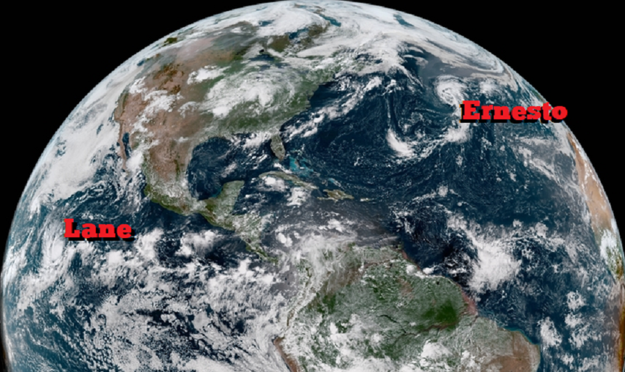
The National Hurricane Center has upgraded two tropical cyclones and named them, one in the Atlantic Hurricane Basin named Ernesto, and one in the Eastern Pacific Basin named Lane. Neither is an immediate threat to any land mass.

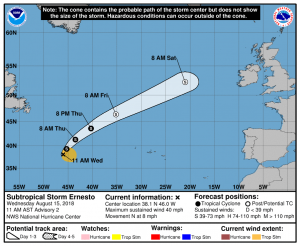
The center of Subtropical Storm Ernesto was located in the northern Atlantic away from any land in the latest advisory from the National Hurricane Center. It was near latitude 38.1 North, longitude 46.0 West. The storm is moving toward the north near 8 mph. A turn toward the north-northeast is expected later today, and a faster northeastward motion is expected by late Thursday and should continue through early Saturday. Maximum sustained winds have increased to near 40 mph with higher gusts. Some additional strengthening is possible during the next 24 hours. The system is expected to become a post-tropical cyclone Thursday night or early Friday. Winds of 40 mph extend outward up to 160 miles from the center. The estimated minimum central pressure is 1008 mb (29.77 inches).
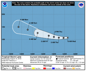
In the Eastern Pacific Basin, the National Hurricane Center is issuing advisories on Tropical Storm Lane. Like Ernesto, Lane isn’t located near any land. In about a week, it could approach Hawaii, but most forecast guidance suggests another miss with the islands; a similar situated played out with the near passage of Hurricane Hector last week.

Lane is the more impressive of the two storms. The latest satellite imagery shows that the cyclone continues to become better organized with a growing central dense overcast along with ample banding features. According to the National Hurricane Center, further intensification is likely over the next few days as Lane encounters a conducive large-scale environment consisting of low shear and fairly warm waters. Rapid strengthening is a distinct possibility after the cyclone forms an inner core, which could take a day or so given that there is still some drier air in the eastern semicircle. The DTOPS rapid intensification index indicates a high probability of significant strengthening over the next 3 days, with over a 70 percent chance of a 65-kt increase during that time. According to computer forecast model guidance and the experts at the National Hurricane Center, Lane seems
destined to eventually become a category-4 hurricane like Hector.
While Lane isn’t an immediate threat to Hawaii, and may never be a threat to the Aloha State, people in Hawaii are encouraged to have a Hurricane Action Plan in place in the event it becomes necessary to act on it should Lane or any future storm impact the state.
Elsewhere, the Pacific and Atlantic basins are quiet with no impacts to the U.S. expected at all for the next 5 days.