• Skip to primary navigation
  • Skip to main content
  • Skip to primary sidebar

Weatherboy

Weatherboy Weather News, Maps, RADAR, Satellite, and Forecasts.

  • Local
  • Earth Science News
  • RADAR
  • Current Warnings
  • Satellite
  • Current Maps
  • Forecast Maps
  • Video

Flooding Rains Possible Friday

by Weatherboy Team Meteorologist - July 5, 2018

This image shows different computer forecast model output for Friday's heavy rains. While different model rains suggest different amounts, they all call for very heavy rain somewhere in the northeast. Image: NWS
This image shows different computer forecast model output for Friday’s heavy rains. While different model rains suggest different amounts, they all call for very heavy rain somewhere in the northeast. Image: NWS


As a cold front washes away the persistent heat and humidity that has plagued the eastern United States, a dangerous heavy rain event appears to be in the forecast, with flooding rains very likely in portions of the Mid Atlantic and Northeast. Due to the threat of severe flooding, the National Weather Service has already issued Flood Watches for portions of New York, New Jersey, Pennsylvania, Connecticut, Massachusetts, Ohio, West Virginia, Rhode Island, and Maryland.

A Flash Flood Watch means that there is the potential for flash flooding which can be life-threatening. With tomorrow’s frontal passage, heavy rain is expected to occur over a short period of time. Rapidly rising flood waters may quickly inundate roadways and areas of poor drainage. Streams and creeks could leave their banks, flooding nearby properties.


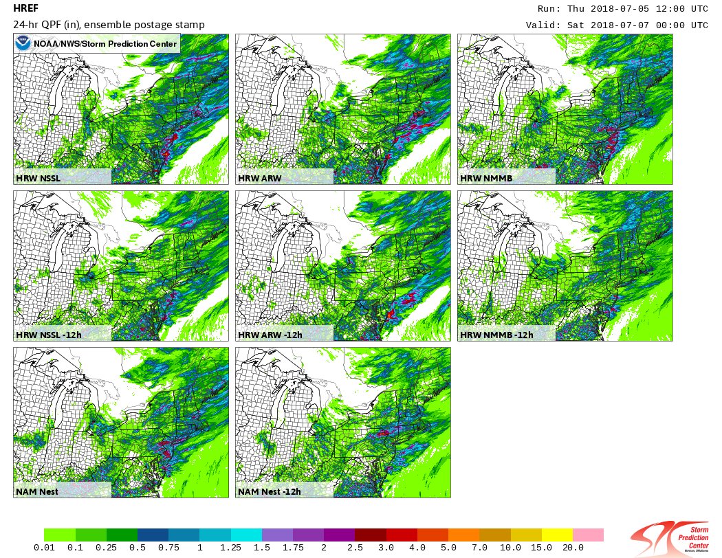
The National Weather Service is urging people in the Flood Watch areas to monitor the evolving forecast, especially if they’re in a location prone to flooding. “Be prepared to take action if a Flash Flood Warning is issued for your area,” the National Weather Service cautioned today. A period of heavy rain and thunderstorms could result in flooding issues early Friday morning through Friday afternoon. Generally, 1 to 2 inches of rain is expected, with localized amounts of 3 to 4 inches possible. The heaviest rain is expected to fall during the morning hours, impacting the morning commute across the I-95 corridor between Baltimore, MD and Boston, MA.  Excessive rainfall within a short period of time can lead to rapidly rising water and flash flooding, particularly in urban areas and along small creeks and streams.

Once the soaking heavy rains clear the coast later tomorrow, fair and dry weather with much more comfortable dew points will move into the region for Saturday.

Primary Sidebar

Sponsored Ad

Search

Latest News

  • National Weather Service Issues Extremely Rare Ashfall Warning
  • Catastrophic Ice Storm to Glaze Texas to New Jersey In Ice; Thick Ice Likely in South
  • Red Alert: National Weather Service Paints Large Part of Country in Red for Winter Storm Impacts
  • Weak Earthquake Strikes North Carolina Before Winter Storm
  • Weak Earthquake Strikes Heart of New Madrid Seismic Zone Today
  • Weak Earthquake Rattles Connecticut
  • Significant Winter Storm to Bring Over Foot of Snow to I-95 Corridor; Philadelphia & New York to Be Hit Hard
  • Weather Emergency Unfolds in Texas; Winter Storm Watches Up For Dallas, Houston, Austin
About | Careers | Contact | Contests
Terms | Privacy | Ad Choices
Weatherboy is a (R) Registered Trademark of isarithm LLC, All Rights Reserved.
All content herein is Copyright by Isarithm LLC 1997-2022

Insert/edit link

Enter the destination URL

Or link to existing content

    No search term specified. Showing recent items. Search or use up and down arrow keys to select an item.