
Heavy rain early today created flood conditions around New Jersey; with more heavy downpours likely to hit the Garden State, forecasters are warning more flooding is on the way too to portions of New Jersey, Pennsylvania, New York, Connecticut, Rhode Island, and Massachusetts.
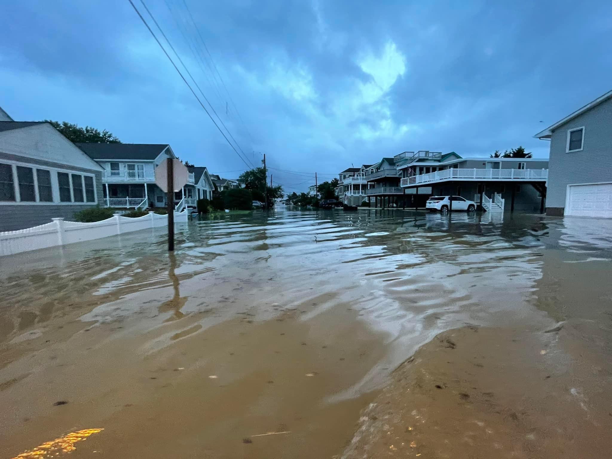
According to the National Weather Service office in Mount Holly, New Jersey, one mesonet station near Surf City reported 5.77″ of rain while other stations on Long Beach Island reported anywhere from 2-4″ of rain.
The National Weather Service says more heavy rain is likely later today as a fresh round of thunderstorms and showers fire-up in the afternoon heating of the atmosphere. The widespread showers and thunderstorms this morning have produced scattered areas of locally heavy rainfall and some isolated cases of flash flooding in New Jersey. The wave associated with this activity
will continue to lift into southern New England this afternoon. Additional scattered showers and thunderstorms are expected to develop later this afternoon and early evening as surface based instability builds near and south of the warm front.
The National Weather Service says there’s a risk of excessive rainfall Wilmington, Delaware and Philadelphia, Pennsylvania northward into much of New Jersey and southern New England with precipitable water potentials around 2″.
Showers and thunderstorms will gradually push off to the east tonight, moving east of the urban corridor and the I-95 area around midnight or so. With light winds and plenty of moisture in the air and on the ground, patchy fog can form throughout the region tonight, creating poor visibilities.
Until then, the National Weather Service warns there could be isolated flooding and flash flooding through tonight in areas that see the heavier showers and storms. “Turn around, don’t drown; never drive through flood waters,” the weather service advises.
