
Computer forecast models have been rather volatile of late, producing 5+ day forecasts that show threats of significant snowstorms in the northeastern U.S. In late October, they suggested one for Halloween which didn’t pan out. Over the weekend, they suggested another significant storm for later this week; only a light snowfall is expected in the northeast. And now they’re suggesting a significant coastal storm for next week. But can it be believed?
The American GFS forecast model is one of many that meteorologists use to aid their forecasting work. Run several times each day, the deterministic model output runs through various scenarios of how the atmosphere will evolve over time, spelling out where highs and lows on a weather map will be featured. They also analyze the complicated physics and dynamics that occur well above the surface; they also incorporate data from the ground; lack of snow cover or the presence of snow cover could alter forecast output. On a short-term basis, models, including the GFS, can be especially accurate. But in the extended range, especially beyond five days, the accuracy begins to become unreliable. While the GFS and other global models like it can be right about conditions 10+ days in the future, it’s more likely than not that they’ll be off.
The last three runs of the American GFS forecast model have indicated once again a sizeable snowstorm threat for the eastern U.S. early next week. Other forecast models show different forecast solutions. Because the current American GFS forecast model output for next week is too far out to put much weight in its outlook, people shouldn’t rush out to stock up snowstorm supplies anytime soon. But with days getting shorter and temperatures getting colder, snow is likely to fall sooner rather than later. Whether it arrives with substance next week is anyone’s guess for now, but it does bear some watching in the days and weeks ahead.
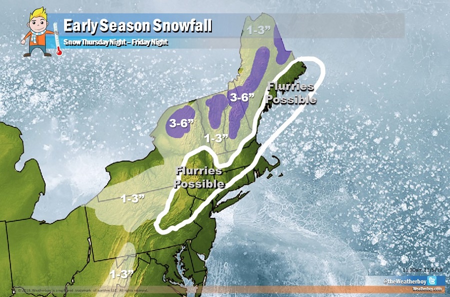
In the meantime, light snow is coming to the northeast. However, the big cities along the I-95 corridor should avoid any accumulations. Widespread 1-3″ is possible, with some higher terrain expected to see 3-6″ of snow by Friday night.
