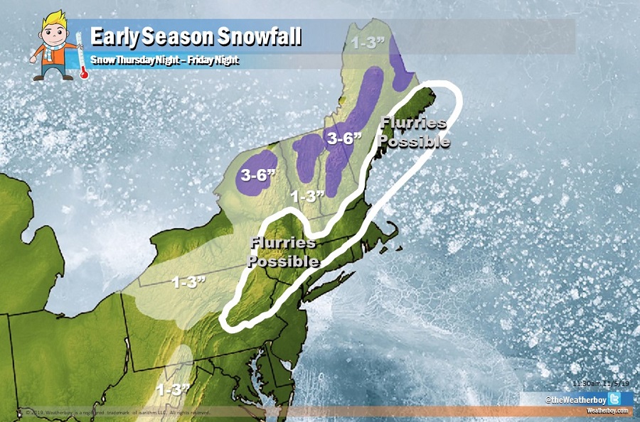
An area of low pressure will provide portions of the northeastern U.S. with their first taste of winter later this week. A light snow accumulation is expected across interior New England with higher elevations receiving somewhat heavier amounts. Snow flurries are also possible to the south of the accumulating snow area from Boston to New York City’s northwestern suburbs.
The system responsible for this snowfall is arriving from the west. During the day on Thursday and into Thursday night, a cold front will approach the Mid Atlantic and New England areas, crossing both by late Thursday night. Low pressure will develop and move along this front, bringing light precipitation to the region from later Thursday into late Friday from southwest to northeast. Temperatures won’t be cold enough for snow in places like Philadelphia and New York City, but just north and west, snowflakes should fly, especially on Friday. Widespread 1-3″ is expected across interior portions of the northeast and high peaks in West Virginia and Maryland. Up to 3-6″ could fall in the higher terrain of northern upstate New York, northern Vermont and New Hampshire, and central Maine.
High pressure will temporarily return for the weekend, only to be followed by a fresh storm system in this area by Monday/Tuesday.