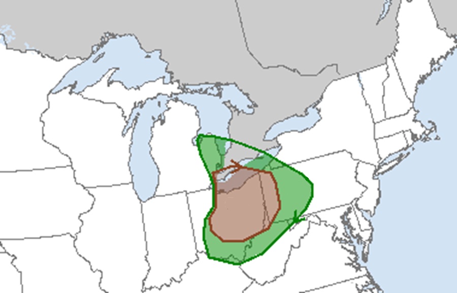
There is a growing threat of tornadoes around portions of Ohio and Pennsylvania today, prompting the National Weather Service to issue a Tornado Watch there. The Tornado Watch, located near and around the Ohio / Pennsylvania state line, is in effect until midnight tonight. Some northern Western Virginia counties are also included in the Tornado Watch.
According to the Storm Prediction Center, scattered thunderstorms capable of producing damaging winds, large hail, and a few tornadoes remain possible across parts of the Ohio Valley and Lower Great Lakes this afternoon. Satellite imagery continues to show a negatively tilted upper trough extending from the Upper Midwest into the Ohio Valley. A surface low associated with this trough is currently over northeast Wisconsin; an occluded front extends southwestward from this low to a triple point in the southern Lake Michigan vicinity. From this triple point, a warm front extends east-southeastward across southern Lower Michigan into northeast Ohio and a cold front extends south-southwestward across western Indiana and southern Illinois. Strong to severe thunderstorms are anticipated along and ahead of the cold front as it moves across the Ohio Valley and Lower Michigan today and tonight. This cold front will then become stationary as it becomes more east-west orientated over Arkansas before transitioning into a warm front near Oklahoma.
With the elevated risk of tornadic thunderstorms, a Tornado Watch is in effect in the Pennsylvania counties of Allegheny, Crawford, Lawrence, Washington, Heaver, Erie, Mercer, Butler, Greene, and Venango, the Ohio Counties of Ashtabula, Carroll, Geauga, Jefferson, Monroe, Noble, Stark, Tuscarawas, Athens, Columbiana, Guernsey, Lake, Morgan, Perry, Summit, Washington, Belmont, Coshocton, Harrison, Mahoning, Muskingum, Portage, and Trumball, and the West Virginia counties of Brooke, Harrison, Monongalia, Ritchie, Wetzel, Doddridge, Marion, Ohio, Taylor, Wood, Hancock, Marshall, Pleasants, and Tyler.
A Tornado Watch means conditions are favorable for tornadoes and severe thunderstorms in and close to the watch area. The National Weather Service warns, “Persons in these areas should be on the lookout for threatening weather conditions and listen for later statements and possible warnings.” The tornado watch area is approximately along and 55 statute miles east and west of a line from 20 miles east southeast of Parkersburg, West Virginia to 45 miles north of Youngstown, Ohio.
Thunderstorms currently ongoing across central Ohio are expected to continue progressing eastward this afternoon and evening. The environment ahead of these storms will remain supportive of supercells capable of tornadoes, hail from 1″ to 1.5″, and damaging gusts from 45 to 65 mph.