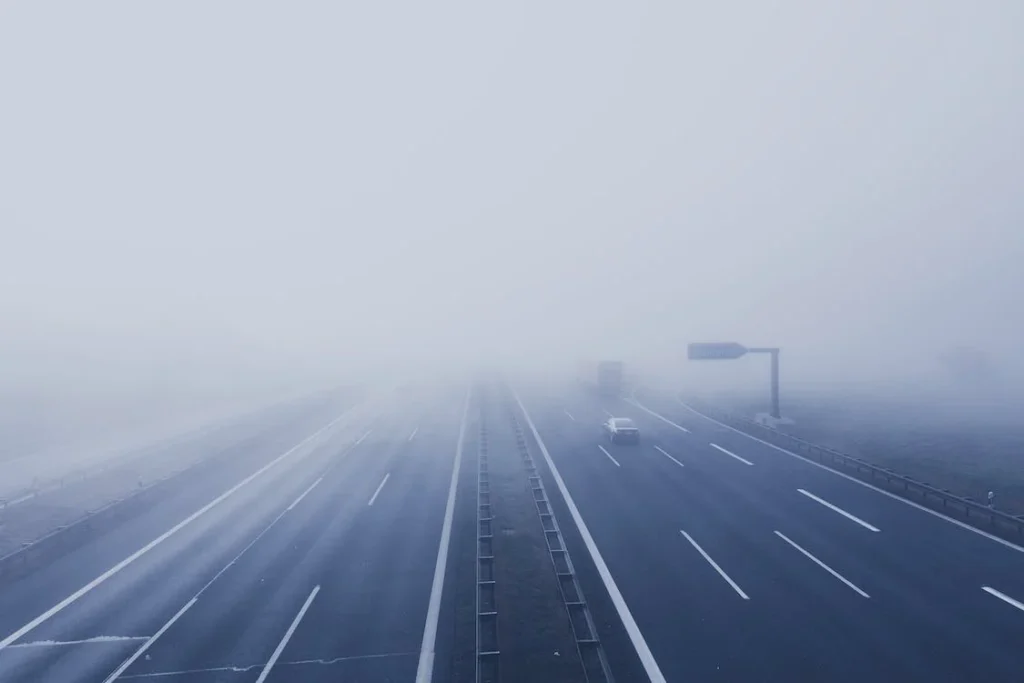
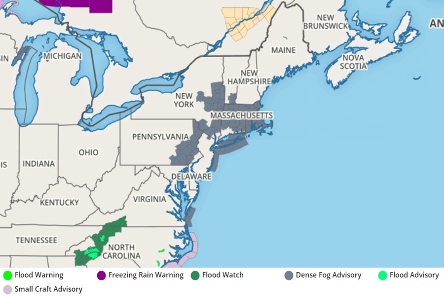
Hazardous fog from the overnight hours continues to persist in portions of the Northeast this morning, prompting the National Weather Service to issue a Dense Fog Advisory for portions of Pennsylvania, New Jersey, New York, New Hampshire, Massachussetts, Rhode Island, Connecticut, Vermont, and Virginia.
A Dense Fog Advisory is issued when fog reduces visibility to 1/8 mile or less over a widespread area. For marine products, an advisory is issued when there is widespread or localized fog reducing visibilities to regionally or locally defined limitations not to exceed 1 nautical mile. A mix of land and marine based advisories are in effect for today’s fog. Fog becomes hazardous at anytime visibility drops below 1/4 mile.
But where does it come from? There are actually a variety of different kinds of fogs created by various situations. Today’s fog is considered to be an advection fog, which is a fog that forms when warm air flows over a cold surface and cools from below until saturation is reached.
But there are other kinds of fog too.
Evaporation-mixing fog forms when the evaporation of water raises the dew point of the adjacent air.
Ground fog, also known as radiation fog, is produced over the land by the cooling of the lower atmosphere as it comes in contact with the ground. The term “radiation fog” is used specifically when outgoing longwave radiation cools the near-surface air below its dew point temperature.
There is also ice fog, which is also referred to as ice-crystal fog, frozen fog, frost fog, frost flakes, air hoar, and rime fog. This type of fog, composed of suspended particles of ice; partly ice crystals 20 to 100 micron in diameter, but chiefly ice particles about 12-20 micron in diameter, is formed by direct freezing of supercooled water droplets with little growth directly from the vapor. It occurs at very low temperatures, and usually in clear, calm weather in high latitudes. The sun is usually visible and may cause halo phenomena. Ice fog is rare at temperatures warmer than -30°C, and increases in frequency with decreasing temperature until it is almost always present at air temperatures of -45°C in the vicinity of a source of water vapor. Such sources are the open water of fast-flowing streams or of the sea, herds of animals, volcanoes, and especially products of combustion for heating or propulsion. At temperatures warmer than -30°C, these sources can cause steam fog of liquid water droplets, which may turn into ice fog when cooled.
Rain can also induce fog. When warm rain falls through cooler air, water evaporates from the warm rain. It subsequently condenses in the cool air forming fog. Such fog can be quite dense. It generally will persist as long as the rain continues. Since temperature rises little during the day, there is little diurnal variation in rain induced fog. Improvement in visibility cannot be expected until the rain stops or moves out of the affected area.
Sea fog is common advection fog caused by transport of moist air over a cold body of water.
Shallow fog occurs when the visibility at 6 feet above ground level is 5/8 of a mile or more and the apparent visibility in the fog layer is less than 5/8 of a mile.
Steam fog forms when water vapor is added to air which is much colder than the source of the vapor. It may be formed when very cold air drifts across relatively warm water. At temperatures below about-20°F, ice particles may be formed in the air producing a type of ice fog known as frost smoke.
Finally, there’s upslope fog, which forms when moist, stable air is carried up a mountain slope.
Foggy conditions can also create two unique meteorological situations: fogbows and freezing fog, A fogbow is a rainbow that has a white band that appears in fog, and is fringed with red on the outside and blue on the inside. Freezing fog forms when the droplets inside fog freeze upon contact with exposed objects and form a coating of rime and/or glaze.
