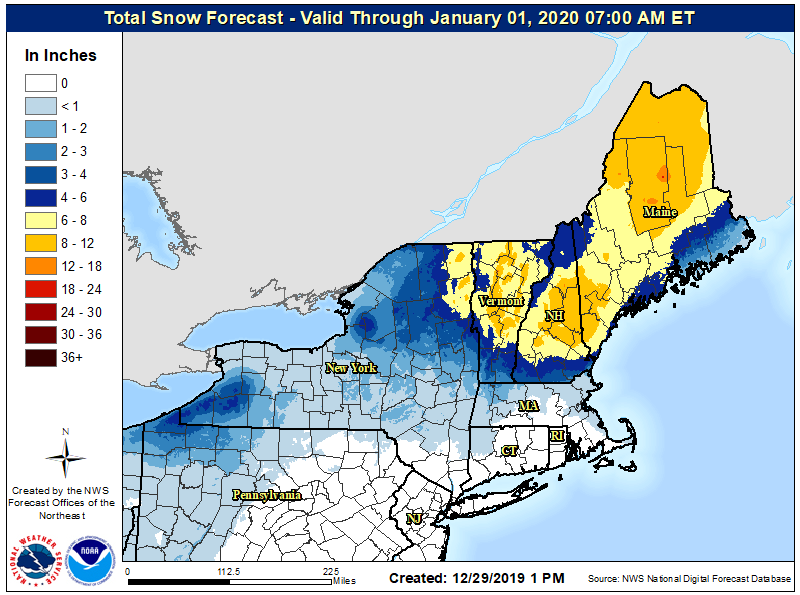
An icy mix of freezing rain, sleet, and snow will fall over portions of the northeast for the next 48 hours as a complex weather system moves through. Portions of Vermont, New Hampshire, and Maine could see 8-12″ of snow, while some isolated higher peaks in Maine could see a foot or more of snow. While the snow will make travel tricky for some, sleet and freezing rain falling in northeastern Pennsylvania, northwestern New Jersey, and southern Upstate New York this evening could make travel outright treacherous as a glaze of ice is put down by the storm.
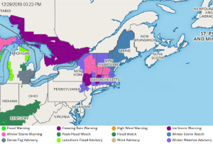
With the threat of significant ice, an Ice Storm Warning has been issued for the Catskills in central New York through Monday night. Winter Weather Advisories have been issued for Oneida County in New York, for the Poconos in northeastern Pennsylvania, and northwestern New Jersey too.
The storm system will bring two serious impacts to the northeast. The first and most impactful will be the threat for significant icing due to freezing rain. The second threat will be the 1-2 inches of rain into already saturated basins, and rising smaller rivers and tributaries.

The warm air aloft associated with an approaching warm front will ride up and over a wedge of cold air near the surface. This cold air is expected to get dammed-up across central New York and create favorable thermal profiles for freezing rain, mainly from the southern Tug Hill into the Catskills and south into the Poconos. An initial push of surface sub-freezing air from the east will be seen late this afternoon and tonight, which when combined with the broad area of precipitation will result in freezing rain in locations that are cold enough. The cold air is expected to retreat slightly to the east later tonight and Monday morning, but remain locked in place over the higher terrain of the Catskills above 1,800 feet through the night and most of the day tomorrow. This will likely cause very dangerous road conditions, with travel near I-88 and Route 17 severely impacted. The threat for heavy ice accretion is expected to be during the over night hours tonight, with precipitation rates subsiding slightly through the day Monday. Total ice accumulations will generally range from a tenth to a quarter of an inch in the Winter Weather Advisory areas and around a quarter to a half inch in the Ice Storm Warning area. Some locations above 1,800 feet could see as much as 3/4″ accumulation which would be enough to bring down trees and wires, resulting in the potential for a long-duration power outage.
The second part of this event is the amount of rain expected, which could cause minor impacts along smaller streams and tributaries of the Upper Susquehanna and Upper Delaware and the Oneida Lake basin. With 1-2 inches of rain into an already saturated surface that is in winter mode, there should be quick runoff into the rivers and bring several levels up to flood threat levels.
While soaking rains will fall to the south, accumulating snow will fall to the north. Enough cold air should change any icy mixture over to plain snow over central and northern New England before the system exits on Wednesday.