• Skip to primary navigation
  • Skip to main content
  • Skip to primary sidebar

Weatherboy

Weatherboy Weather News, Maps, RADAR, Satellite, and Forecasts.

  • Local
  • Earth Science News
  • RADAR
  • Current Warnings
  • Satellite
  • Current Maps
  • Forecast Maps
  • Video

Heavy Rain Returns to Mid Atlantic

by Weatherboy Team Meteorologist - August 8, 2018

More showers and storms are forming in the Mid Atlantic, dropping heavy amounts of rain into an area that is saturated. Image: weatherboy.com


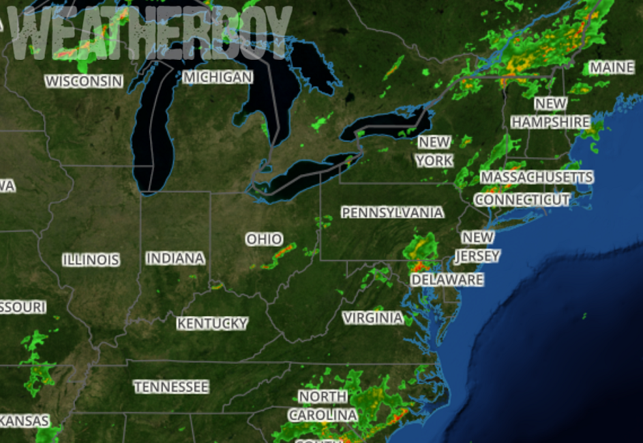
After a very wet July, it doesn’t appear the Mid Atlantic can catch a break; more heavy showers and thunderstorms are building and moving through the Mid Atlantic, soaking regions that are already soaked. A short wave trough across the Great Lakes region paired with a stronger trough in south-central Canada are working together to create wet weather conditions. At the surface, a cold front is draped across the eastern Great Lakes while a trough is positioned near the I-95 corridor. Both of these features will play a role in our weather through tonight, although according to the National Weather Service,  it looks like the cold front will be slow to arrive.  This set-up will continue to fire-up thunderstorms and rain showers in portions of the Mid Atlantic, with cells gradually evolving eastward.

While some cells may create damaging winds, the larger threat is from heavier rains.  As one could feel with the heat and humidity today, the air mass is moisture laden. Any  convection that fires-up will produce locally very heavy rain which could result in localized flooding.


With soaking rains, frequent lightning, and strong winds, the National Weather Service has flood and severe thunderstorm warnings up for portions of the Mid Atlantic now. More may be possible as the area of showers and storms continue to blossom and head East.

The National Weather Service reminds everyone to “turn around, don’t drown; never drive through flood waters.” For additional flood safety information, visit our Flood Information Center here.

Primary Sidebar

Sponsored Ad

Search

Latest News

  • USGS Scientists Monitoring Volcano for Signs of Eruption
  • Swirl of Clouds Causes Concern Near Florida Day Before Hurricane Season Starts
  • People Report Shaking as Earthquake Strikes New Hampshire
  • Smoke from Nova Scotia Fires Invade New Jersey; Prompts Air Quality Alert
  • Multiple Earthquakes Shake Kentucky & Tennessee, Not Far from New Madrid Seismic Zone
  • May Ends on a Very Dry Note in the Northeast; Philadelphia About to Break Record
  • Carnival Sunshine Cruise Ship Sails into East Coast Storm, Creating Injuries & Damage On-Board
  • Space Weather Forecaster Sought; Pay Up to $183,500/year Offered
About | Careers | Contact | Contests
Terms | Privacy | Ad Choices
Weatherboy is a (R) Registered Trademark of isarithm LLC, All Rights Reserved.
All content herein is Copyright by Isarithm LLC 1997-2022